Alexandria Waterfront Documentary Study
Alexandria Waterfront Documentary Study
In June 2020, the Office of Historic Alexandria, with the support of the Department of Project Implementation, began the research for and preparation of a detailed documentary study of the Alexandria waterfront. Proposed plans to mitigate flooding triggered this dive into history.
The final product is a comprehensive report on the historical development of this six-block area. This report serves as the historical guide for archaeological assessments of proposed and future infrastructure and development projects within this portion of the waterfront.
A spatial database preservation tool has also been created in GIS (geographic information system).
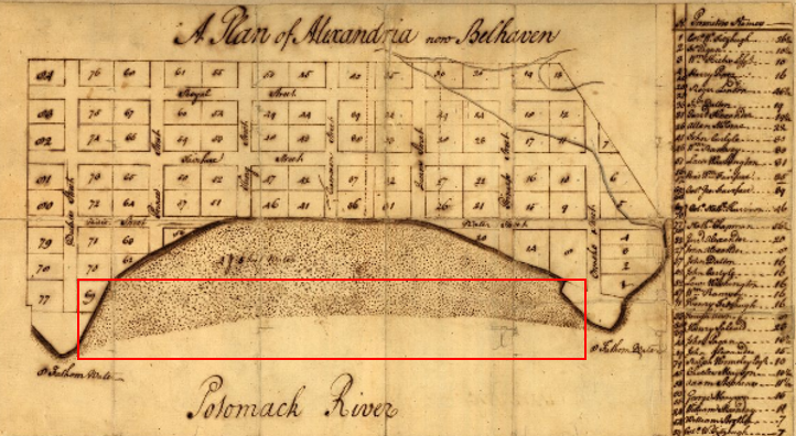
The report includes a chain of title, a description of the historic owners and occupants, and a discussion of the land creation and use of each block through time. The study area includes the land between Union Street and the Potomac River from Founder’s Park to Duke Street. This area represents the core of the port town’s historic waterfront as it evolved from a small hamlet to an industrial seaport. The research references blocks to the west of Union Street to demonstrate how the land was built out from the original shoreline.
Research themes that emerged include Alexandria's maritime culture and the extension of the shoreline, women as property owners, and the economic role of slavery in the making of the waterfront.

The report will include a chain of title, a description of the historic owners and occupants, and a discussion of the land creation and use of each block through time. The study area includes the land between Union Street and the Potomac River from Founder’s Park to Duke Street. This area represents the core of the port town’s historic waterfront as it evolved from a small hamlet to an industrial seaport. The research will reference blocks to the west of Union Street to demonstrate how the land was built out from the original shoreline.
Emerging research themes include Alexandria's maritime culture and the extension of the shoreline; women as property owners; and the economic role of slavery in the making of the waterfront.
Project Background
City of Alexandria efforts to mitigate flooding have the potential to impact buried archaeological resources. Previous archaeological and documentary studies recommend a high potential for archaeological features along the waterfront including wharves, structures, and evidence of land filling activities. Potential flood mitigation infrastructure and streetscape stormwater improvements within these blocks will require below-ground solutions that could disturb potential archaeological features. This documentary study is one step to preserve the city’s past.
Archaeology and historical studies conducted in association with flood mitigation include:
- Initial Archaeological Assessment (Stantec, November 2018)
- Preliminary Archaeological Assessment (PAA) for Founders Park (Alexandria Archaeology, November 2022)
- Cultural Resources Work Plan: City of Alexandria Waterfront Improvement and Flood Management Project (Stantec, February 2020)
- Geoarchaeology Report (Mueser Rutledge, February 2023)
For information on Alexandria’s port history more generally, some suggested references include:
- Archaeology on the Waterfront
- City of Alexandria
2010 Alexandria Waterfront History Plan: Alexandria, a Living History. Prepared by Alexandria Archaeology, Office of Historic Alexandria. - Claypool, Julia
2014 Robinson Terminal South: Property History. History Matters, Washington, D.C. Submitted to the City of Alexandria, Virginia. - Preisser, Thomas
1977 Eighteenth-Century Alexandria, Virginia, before the Revolution, 1749-1776. PhD Dissertation, College of William and Mary.
1981 Alexandria and the Evolution of the Northern Virginia Economy, 1749-1776. Virginia Magazine of History and Biography 89:282-293. - Pulliam, Ted
2008 Alexandria's First Wharf. Studies of the Old Waterfront. Alexandria Archaeology, Office of Historic Alexandria.
-
Shephard, Steven J.
2006 Reaching for the Channel: Some Documentary and Archaeological Evidence of Extending Alexandria’s Waterfront. The Alexandria Chronicle Spring 2006:1–13. -
Shomette, Donald G.
1985 Maritime Alexandria: An Evaluation of Submerged Cultural Resource Potentials at Alexandria, Virginia. Donald G. Shomette. Submitted to Office of Historic Alexandria, Alexandria Archaeology, Alexandria, Virginia.See also:
2003 Maritime Alexandria: the Rise and Fall of an American Entrepot. Heritage Books, Inc. -
Woods, Kevin
2019 Founders Park, A Biography. March 26, 2019.
Public Presentations
Regular updates are provided to the Alexandria Archaeological Commission (AAC).
October 25, 2023
New Perspectives on the Old Waterfront: Early Wharves of Alexandria
October 20, 2023
The full video is four hours and is accompanied by a transcript.
Alexandria’s Historic Waterfront Report
Full Report: Alexandria’s Historic Waterfront
Alexandria's Historic Waterfront: A Documentary and Geospatial Study, A parcel-by-parcel documentary study of Alexandria’s historic waterfront from Oronoco Street to Duke Street. Abby Schreiber, Alexandria Archaeology Publication, No. 132, 2023.
Report Sections
Chapter 1: Founders Park
Chapter 2: Queen to Cameron
Chapter 3: Cameron to King
Chapter 4: King to Prince
Chapter 5: Prince to Duke
Journeys on Alexandria’s Historic Waterfront, Waterfront History Plan Updates, An addendum to the Historic Waterfront Report that highlights the important themes and stories that emerged from the documentary study. Abby Schreiber, 2024.
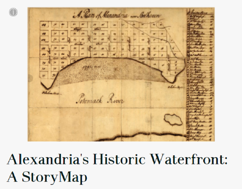
Alexandria’s Historic Waterfront: A StoryMap
This StoryMap, a map-centered and visually rich interpretive website, relies on stories and narrative to explain the changes in the historic waterfront in an engaging and interactive context. This StoryMap exhibit is a companion to the full report.
