Sickel General Hospital
History of Sickel General Hospital
Block bounded by Pendleton, Oronoco, North Payne and North West Streets
The hospital was built for the Second Division. Text on the Quartermaster Map indicates that the hospital was built by Col. Sickel in 1863, and occupied by Surgeon T. Ruels Spenser in 1864.The hospital complex included approximately 24 wood frame structures, ward tents, surgeon’s headquarters, 13 wooden wards, sutler’s building, wash house, dead house, and two sinks (privies). After the War, some of the building materials were said to have been given to the Freedmen’s Bureau to build schools.
- A place for the wounded in Civil War Alexandria. Out of the Attic October 30, 2014.

First Person Accounts
First Person Accounts from the Union Hospitals
- Joseph Richardson
- Letter about patient Robert Marshman
- Joshua Ingalls
Historic Images
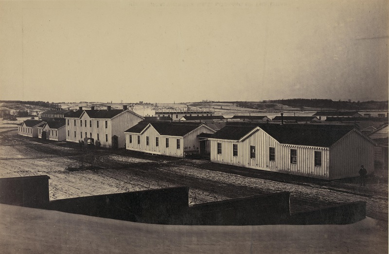
Image 1:
- Title: Bird’s-eye view of Sickel Hospital, looking toward Fairfax Seminary, January 5, 1865.
- Image Source: Library of Congress Prints and Photographs Division
- Photographer: Andrew Russell
- Image Date: January 5, 1865
- Medium: Albumen print
- Library of Congress Reproduction Number: LC-DIG-ppmsca-11696 (digital file from original photograph)
- Library of Congress Call Number: LOT 11486-E, no. 15 [P&P]
- Library of Congress Rights Advisory: No known restrictions on publication.
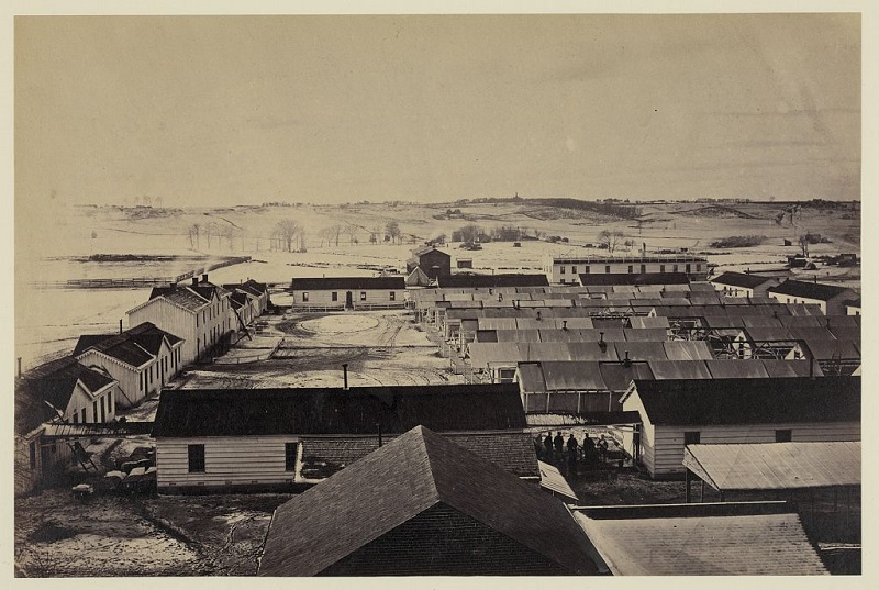
Image 2:
- Title: Bird’s-eye view of Sickel Hospital, Alexandria, Virginia.
- Image Source: Library of Congress Prints and Photographs Division
- Photographer: Andrew Russell
- Image Date: between 1861 and 1865
- Medium: Albumen print
- Library of Congress Reproduction Number: LC-DIG-ppmsca-11695 (digital file from original photograph) LC-B8184-10471 (b&w film copy neg.)
- Library of Congress Call Number: LOT 11486-E, no. 14 [P&P]
- Library of Congress Rights Advisory: No known restrictions on publication.
Quartermaster Map
Quartermaster maps show elevations and plans of the hospital buildings, with a key (transcribed below)
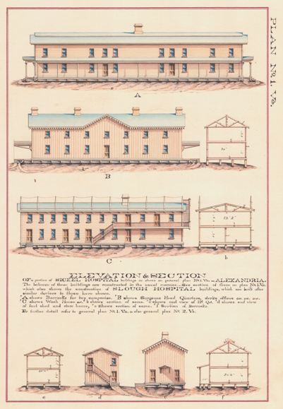
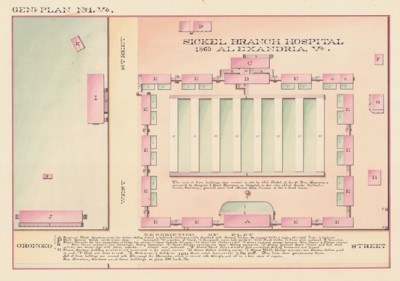
The most of these buildings were erected in 1863 by Col. Sickel, the 8th Penn. Reserves, & occupied by Surgeon T. Rush Spencer, as Hospital, in 1864 who added thereto the Wash-house, Sanitary, general store and officers Mess Houses as also a dead house.
Note below the legend:
Blue lines government fences
All of these buildings are covered with Felt, except the Barracks, which is covered with Shingle, and all in a fair state of repair.
See Elevations, Sections &c. of these building on plans Nos. 1 & 2, Va.

A Surgeons Head Quarters 24’x92’, two stories. Siding vertical & battened, Ceilings & walls sheathed with dressed lumber.
a’s Ward Tents
B Mess House 20’4”x87’7”. Two stories high. Siding horizontal.
bbbb Plank Walks
C Kitchen 20’4”x77’, one story. Siding horizontal.
c’s Covered Walks 6’ wide.
D General Store House and fuel shed 20’4”x60’ two stories high with stairs outside. Siding vertical and battened.
d Veranda
E’s Thirteen Wards 20’x60’4”, one story. Siding horizontal.
e enclosed passage between Mess House & Kitchen 10’8”x 10’3’
F Dead House 16’5”x20’5”, Roof ventilated, Siding horizontal and lapped.
f (Apparently a veranda on G but not identified in the key)
G Sanitary building 20’5”x50’4”, and constructed in the usual manner.
ggggg Watch boxes 3’6”x3’6”
H Sutlers House 16’5”x20’5”, Roof ventilated, Siding horizontal and lapped.
hh Porches 5’2” x 8’6” for wash house (not marked on map)
I Wash House 32’x100’, two stories, clothes yard on roof
i Veranda for wash house (not marked on map)
J Barracks for two companies, 24’6”x128’, two stories.
K Sink 15’x25’
k Sink 8’ x 15’
I's Grass plots enclosed
m A portion of Ward
n Knapsack room – both 20’x60’4”
O Hydrant (between Mess House and Ward Tents)
P Porch and stairs to roof of wash house
q Flag staff (in front of Surgeon’s Headquarters)
Records of the Office of the Quartermaster General, National Archives and Records Administration, Washington, D.C.
Location and the Site Today
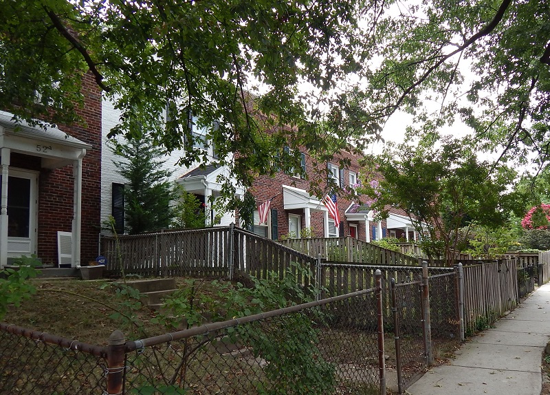
The site is on the block bounded by Pendleton, Oronoco, North Payne and North West Streets. Townhouses from the mid-20th century are now on this site, near the Braddock Road Metro Station.
- Google Map. See the location today.
- Civil War Hospitals Map. See location of hospital in relation to others
- Union Hospitals in Alexandria. Return to main page
- Alexandria Civil War Hospitals. interactive Story Map
- Alexandria Civil War Hospitals. Walking Tour Brochure