About Multi-Use Trails
Multi-use trails are facilities intended for use by pedestrians and cyclists of all abilities that are physically separated from motor vehicle traffic. Trails are designed for two-way travel and can align parallel to a roadway, or follow other geographic features such as waterways, former or active railroads, parks, etc. Multi-use trails can improve safety and comfort for people walking and biking, offer alternatives to driving, and enhance public health and quality of life.
Trail News
Four Mile Run Park Trail Bridge Reopened
As of April 2024, the Four Mile Run Park Trail bridge is reopened to the public following structural repairs. More information is available on the project webpage.
National Park Service Planning Improvements to Mount Vernon Trail
The National Park Service (NPS) is working to enhance the south section of the trail between the City of Alexandria and Fairfax County with upgraded cycling paths and improved pedestrian crossings. More information can be found in the January 2024 press release.
PORTIONS OF HOLMES RUN TRAIL TEMPORARILY CLOSED
Portions of Holmes Run Trail are currently closed due to damage from historic flooding.
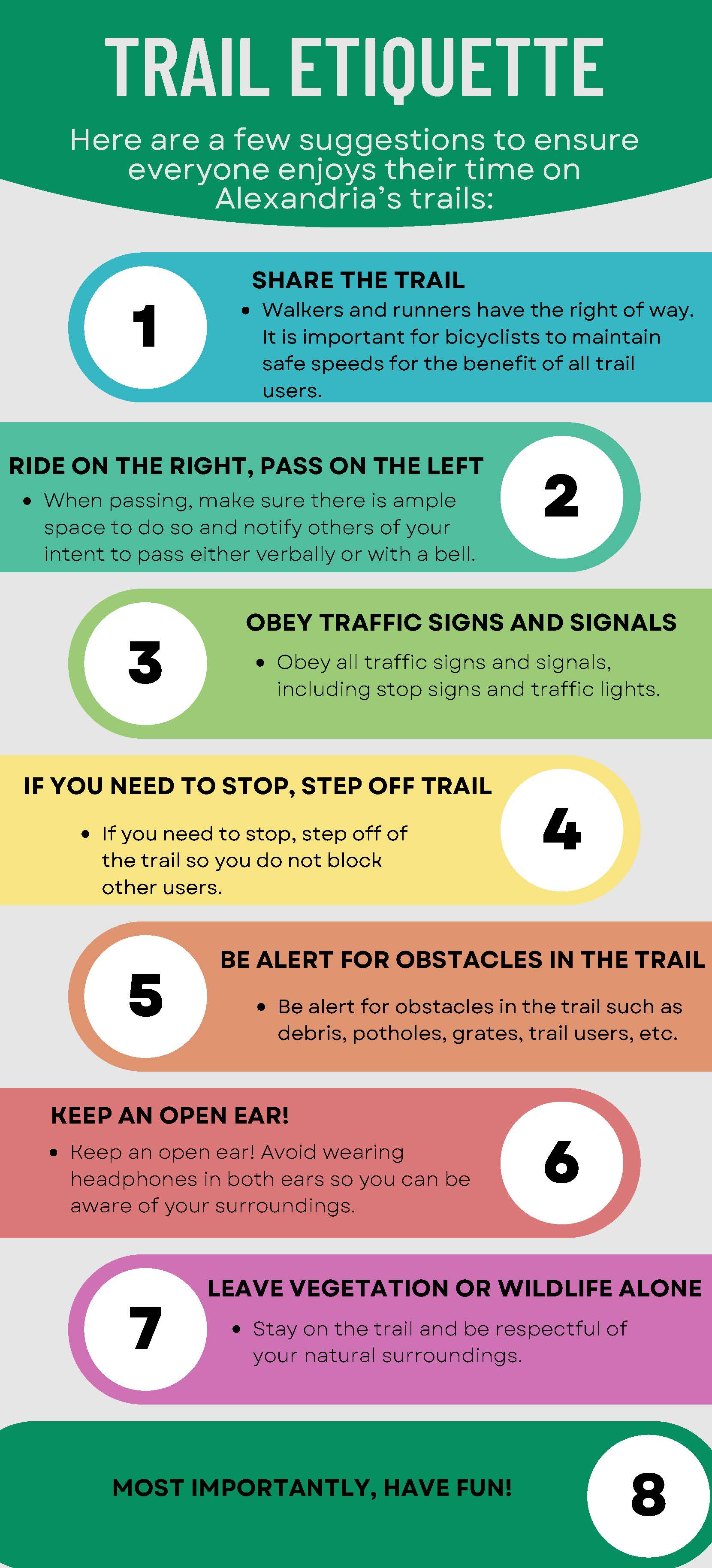
Trail Etiquette
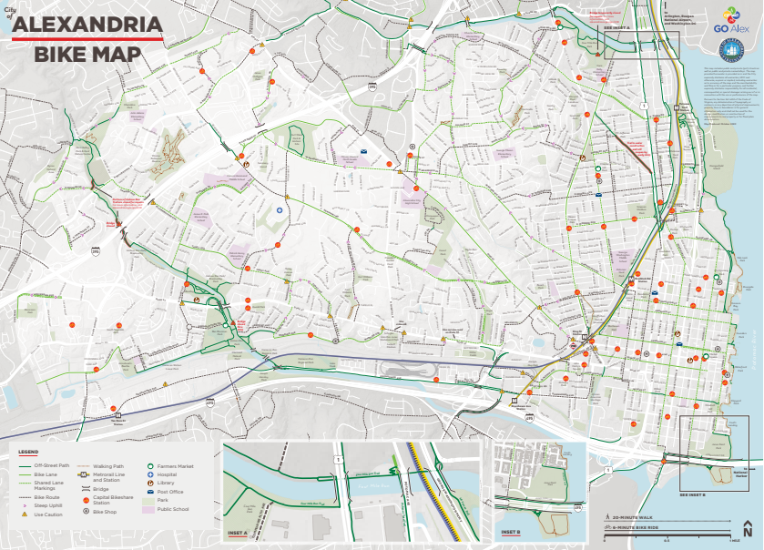
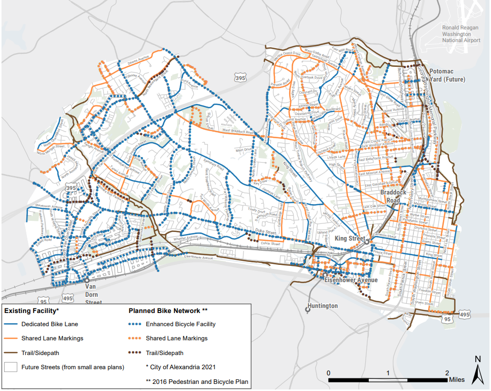
Existing and Planned Trail Network
See below for a map of the bike route network in Alexandria, and learn more about the future bike network as envisioned in the Alexandria Mobility Plan (AMP).
Multi-Use Trail Projects
Trail Profiles
The 0.7 mile Backlick Run Trail connects Ben Brenman Park to Armistead Boothe Park via Backlick Run. The trail runs along the Cameron Station Linear Park and provides access to the Holmes Run Trail Network.
The Beauregard Trail is a future trail that began design work in 2021. This project was recommended in the Alexandria Mobility Plan and the AlexWest Small Area Plan.
The Eisenhower Avenue Trail extends 1.8 miles from Cameron Run Regional Park east towards the Eisenhower Metro Station. The Trail ends near the Metro Station at Stovall Street. The trail also connects to the Holmes Run Trail to the west.
The Four Mile Run Park Trail is a 1.1 mile trail which connects to the Potomac Yard Trail, the Mount Vernon Trail, and Arlington's Four Mile Run Trail. The trail runs through Four Mile Run Park, which features athletic facilities, playgrounds, picnic areas, and more.
The Holmes Run Trail is a 3.1 mile long section of trail extending between Cameron Run Regional Park (and the Eisenhower Avenue Trail), Dora Kelly Nature Park, and the Holmes Run Park. This trail provides connections to N Pickett St, N Van Dorn St, N Beauregard St, and to Arlington.
News: Due to historic flooding in Alexandria in 2019, portions of Holmes Run Trail are currently closed. For more information, click here.
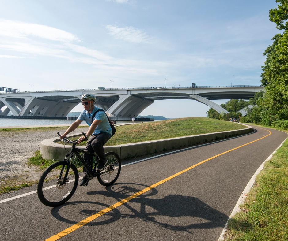
5.6 miles of the 18 mile long Mount Vernon Trail runs through Alexandria. The Trail runs alongside the Potomac River and connects George Washington's Mount Vernon Estate to Theodore Roosevelt Island. The scenic trail also connects to several regional trails including the Four Mile Run Park Trail and Potomac Yard Trail.
The 2.1 mile Potomac Yard Trail runs from the Braddock Road Metro Station North along Potomac Ave to connect with the Four Mile Run Trail. This trail features exercise equipment, basketball courts, tennis courts, and numerous playgrounds.
The Old Cameron Run Trail is a future trail with design beginning in 2017. A Feasibility Study was completed in 2016 which recommended a preferred trail alignment and projected costs. The City used this study to apply for grant funding to continue to design and construct the trail and was awarded funding through the Federal Smart Scale program.
The Mount Jefferson Park Trail starts at the intersection of Commonwealth Avenue and Ashby Street and runs southwest for 1.4 miles through Mount Jefferson Park and Greenway. The trail ends near the Route 1 Trail at the intersection of East Mount Ida Avenue and East Custis Avenue.
Additional Resources
See below for resourceful links.
Contact
To submit a question or comment, please contact Alex311.