You're logged in with MyAlex  |  Logout

City of Alexandria, VA

Search results cleared

Include archived pages
Most of the content here is written in English. Translate your search to find more content? Translating "" to English... Searching for English phrase ""
  • Live
  • Play
  • Services
  • Business
  • Government
  • Projects & Plans
  • Calendar
  • I want to…

Colored Rosemont: Maps and Aerial Images

View maps and aerial images of the neighborhood, from 1877 to 2023.
Page updated on January 18, 2025 at 3:53 PM

Cultural History

  • Historic Alexandria (Home)
  • About Historic Alexandria
  • Alexandria Community Remembrance Project
    • Public Programs
    • Committee Meetings
    • Equal Justice Initiative
    • In Memoriam: Benjamin Thomas
    • In Memoriam: Joseph McCoy
  • African American History
  • Hispanic Heritage
  • Indigenous Peoples
  • Women's History
  • Alexandria Oral History Center
  • African American History Division
  • City Museums
  • News Releases
  • Plan your visit
  • Self-Guided Tours
  • Stay Connected
  • Support Historic Alexandria

Share

Bluesky Share on Facebook Share on X Share via Email
Translate icon
Translate icon
XWARNING: You have chosen to translate this page using an automated translation system. This translation has not been reviewed by the City of Alexandria and may contain errors.

Colored Rosemont: Maps and Aerial Images

The Colored Rosemont Community History Initiative is a collaboration between the Office of Historic Alexandria, and former and current residents of Colored Rosemont. The Initiative seeks to preserve and showcase the important history of this historic African American neighborhood, which was home to some of the first African American homeowners in the City of Alexandria throughout the early-to-mid 20th century. View maps and images of this neighborhood below.

Neighborhood boundaries are more than just a simple matter of geography. People in a neighborhood not only share physical space, but they share the common experience of placemaking within their surroundings. The familiarities and fixtures of a neighborhood—the longtime family that lives at the same address for decades; block parties; the open lot where kids play—these moments and events help people in a neighborhood develop a collective sense of belonging. 

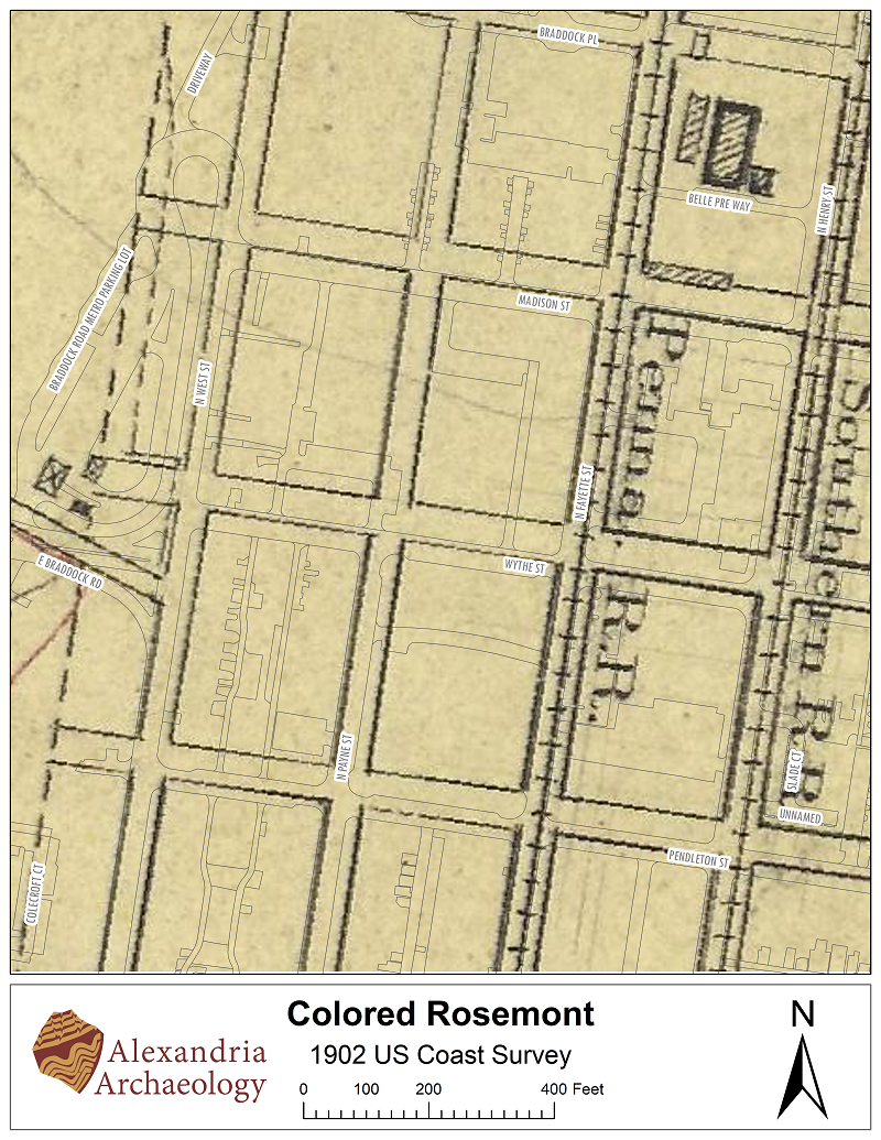
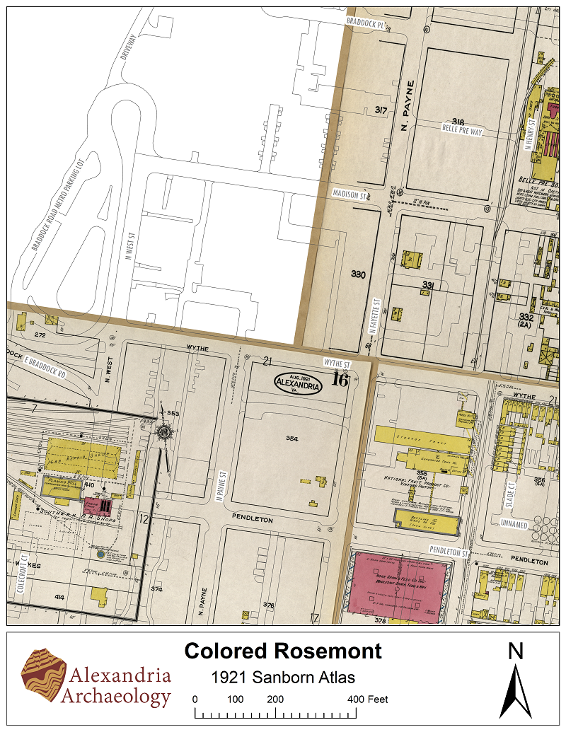
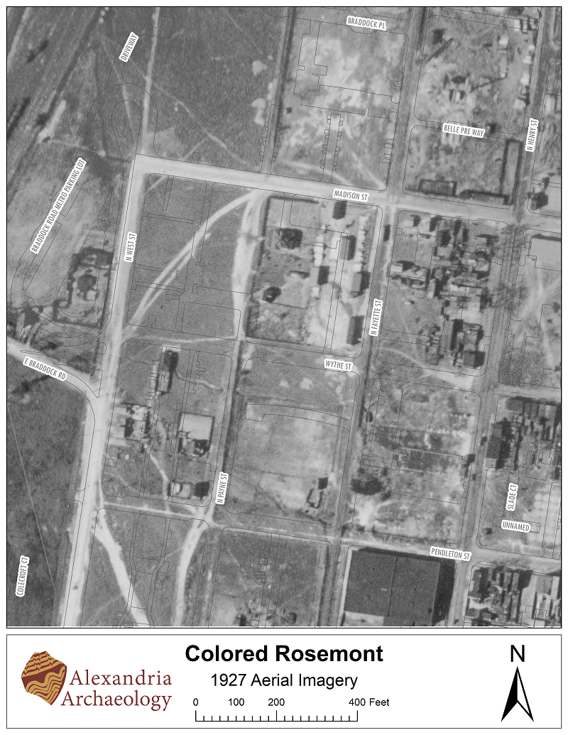
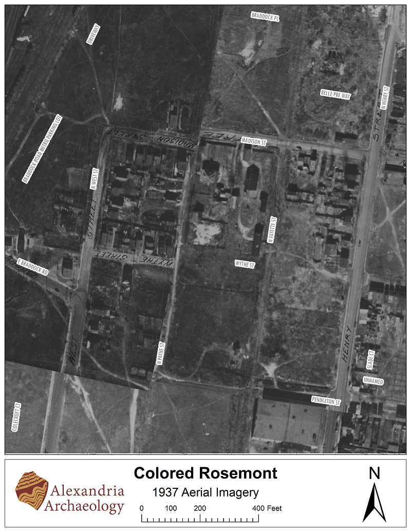
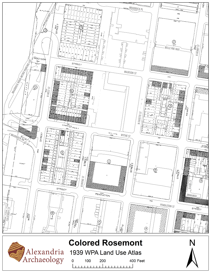
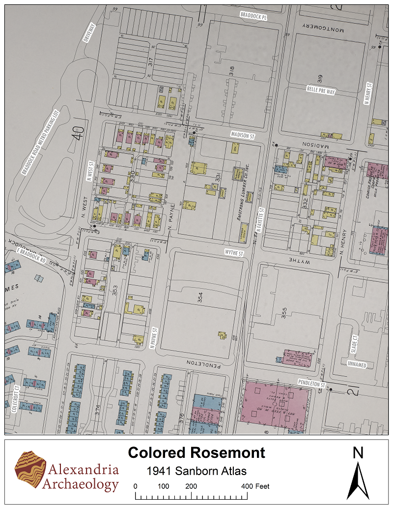
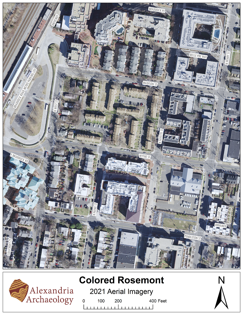
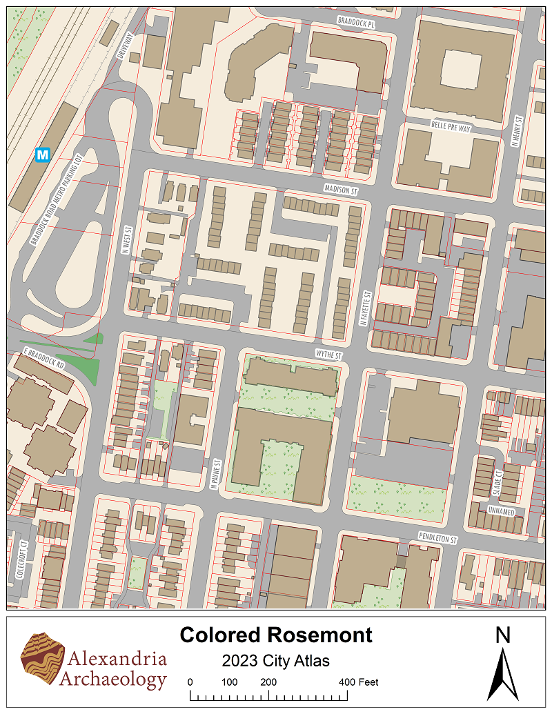
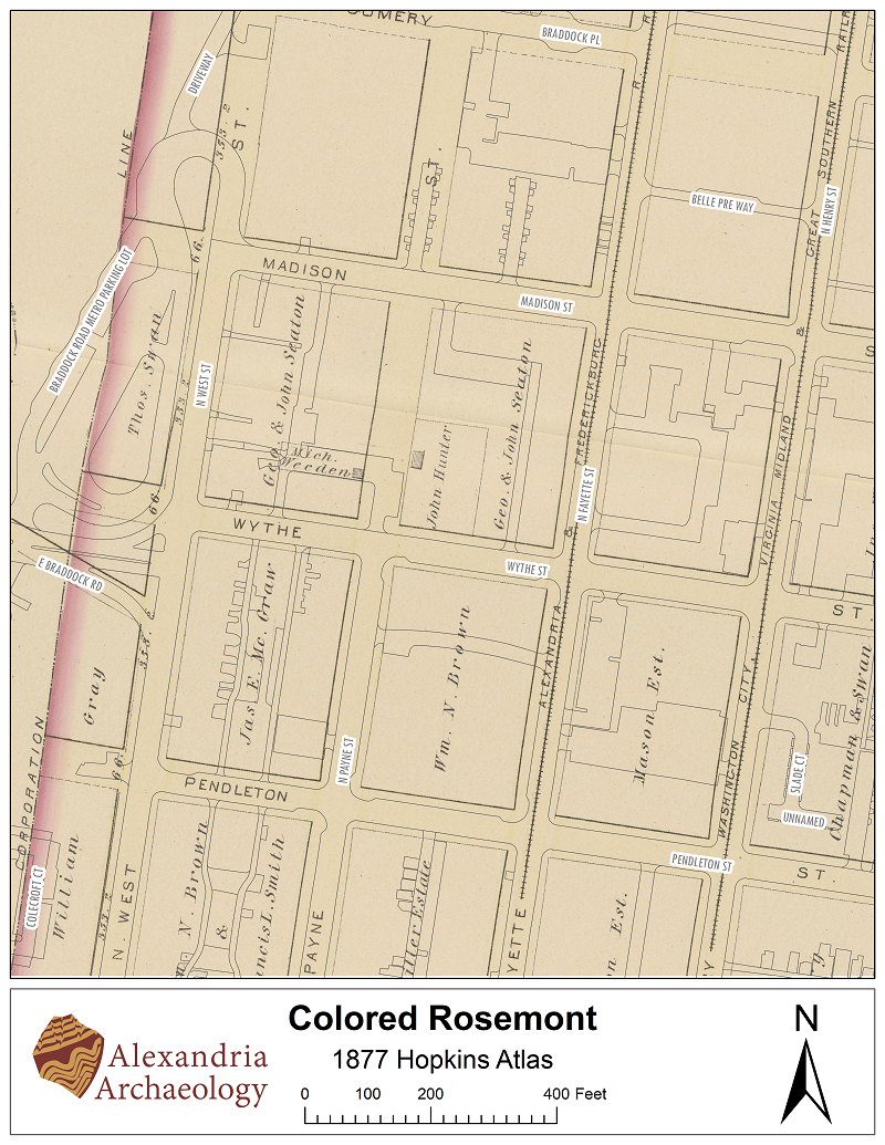
Although fungible, the boundaries of the Colored Rosemont neighborhood formally took shape beginning in 1926 when a local real estate broker, Virginia Fitzhugh Wheat Thomas (1893-1987), acquired and then subsequently subdivided the entire block bounded by N. West St. on the west, Madison St. on the north, N. Payne St. on the east, and Wythe St. on the south. Although she came from a world of white privilege, Thomas actively supported Black homeownership not only in words, but in deeds, quite literally in deeds. In 1928 she began selling lots to prospective Black buyers and did so for the next two decades.  

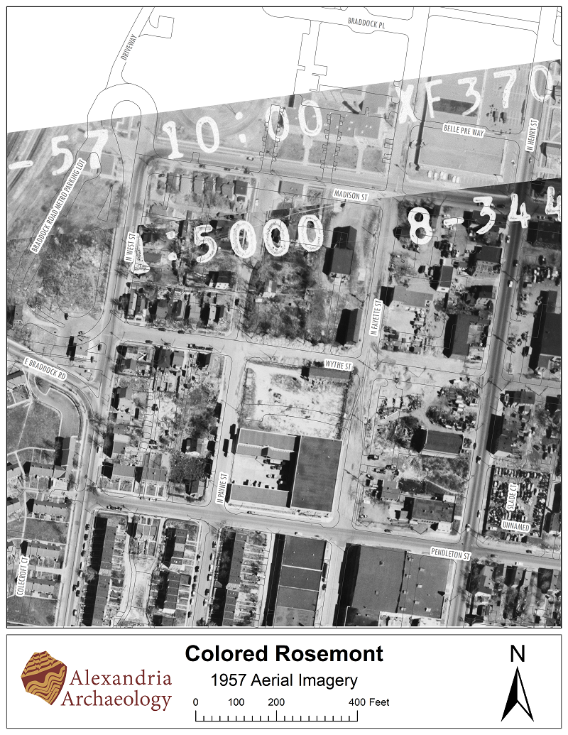
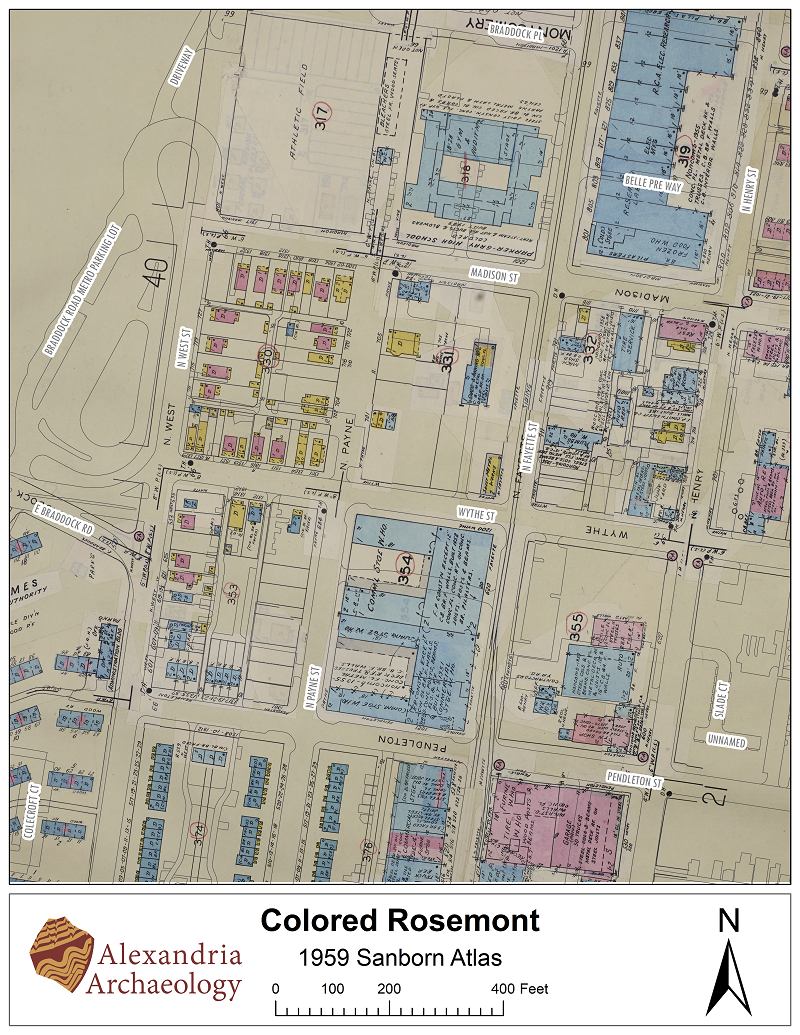
Over time the neighborhood expanded onto the surrounding blocks to an area bound by N. West St. on the west, by Madison St. on the north, by N. Fayette St. on the east, and Pendleton St. on the south. This evolution of the Colored Rosemont neighborhood can be visually charted on a series of historic maps and aerial photographs. The Thomas block, and the adjacent blocks were largely vacant (aside from some light industry) until the late 1920s when new property owners began building houses. By the mid-1930s more than a dozen houses had been built. By the 1940s most of the original Thomas block had been built out, and additional houses were sprouting up on the adjacent blocks. By the 1950s the neighborhood had fully come into being. 

Return to main Colored Rosemont page

1877

1877 Hopkins Map

1877 Hopkins Atlas

1902

1902 US Coast Survey Map

1902 US Coast Survey 

1921

1921 Sanborn map

1921 Sanborn Atlas 

1927

Aerial photo 1927, black and white

1927 Aerial Imagery 

1937

Aerial photo 1937, black and white

1937 Aerial Imagery 

1939

1939 WPA map, black and white

1939 WPA Land Use Atlas 

1941

1941 Sanborn Atlas, color

1941 Sanborn Atlas 

1957

Aerial photo 1957, black and white

1957 Aerial Imagery 

1959

1959 Sanborn map

1959 Sanborn Atlas 

2021

Aerial photo 2021

2021 Aerial Imagery

2023

2023 City Atlas, color

2023 City Atlas 

  • Black History
  • Historic Alexandria
  • Historic Sites
  • Maps
Contact Us
Alex311 | 703.746.4311
Follow Us
  • BlueSky
  • Facebook
  • X
  • YouTube
Visitor Information

VisitAlexandriaVA.com

  • Jobs
  • Payments
  • Departments
  • Newsroom
  • Social Media
  • Emergency Hotlines
  • Accessibility
  • FOIA Requests
  • Privacy & Legal

Alexandria City Hall
301 King Street
Alexandria, VA 22314

City of Alexandria Seal
© 1995–2023 City of Alexandria, VA and others.
Hold on, redirecting...