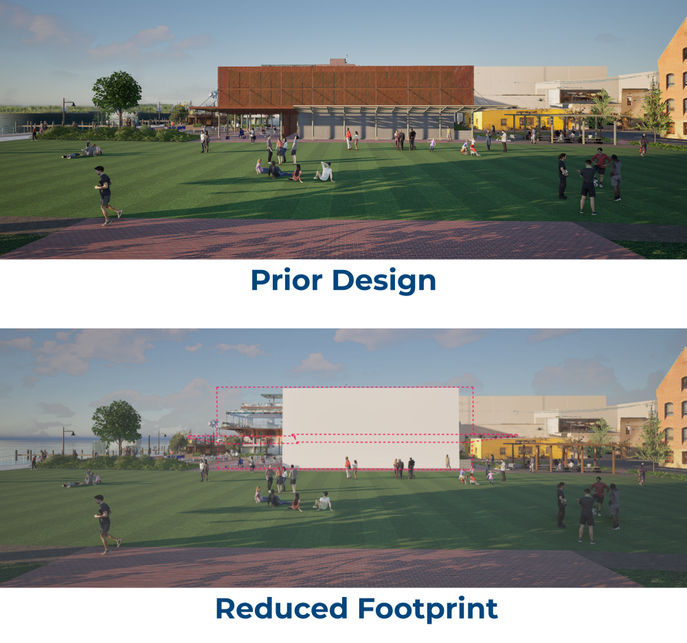
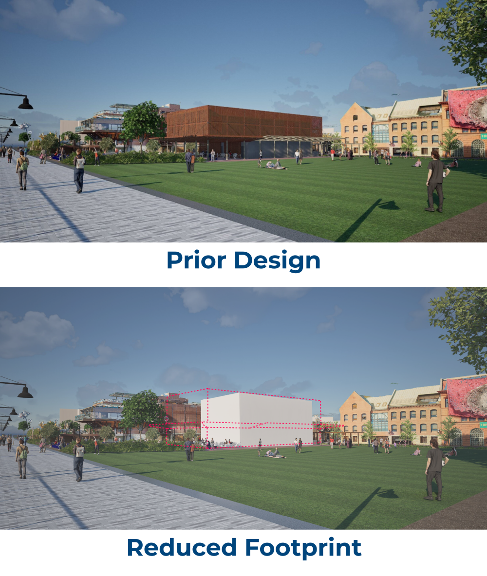
The Waterfront Flood Mitigation Project team is working diligently to evaluate and incorporate constructive pump station design feedback into the project design, as well as explore options for reducing the impact to Waterfront Park, with a continued goal of reducing impacts and maximizing park space for the benefit of residents, businesses, and visitors.
The design team announced on September 3 that preliminary reductions in the building footprint are progressing. The team anticipates being able to reduce the building's length by approximately 18 - 22 ft., and/or the total structure by about 55 ft. if the building canopy is eliminated from the design as well.
In response to community feedback, the architectural design team is focusing on evaluating and exploring refine the building's exterior details. Additional updates on this aspect of the pump station design are coming soon.
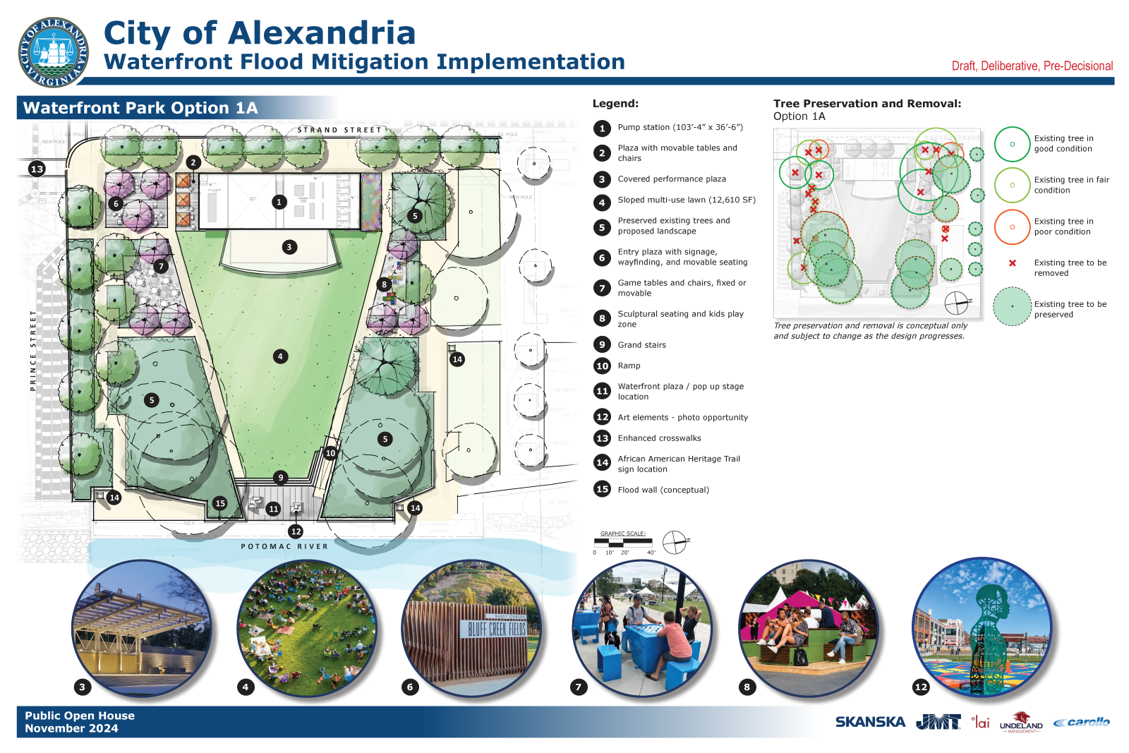
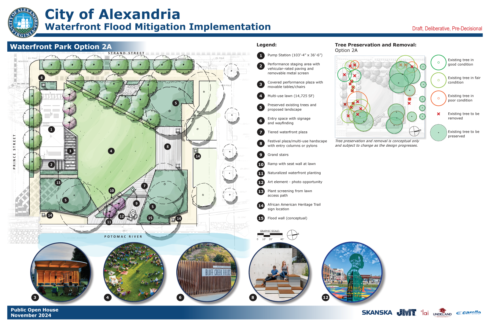
The landscape architecture team is developing alternative designs for Waterfront Park that take the new, smaller footprint into account and replace hardscaping with additional green space. View those designs on the Waterfront Park webpage.
What do you think of the reduced footprint? Use the link below to submit feedback on these designs to the Waterfront Flood Mitigation Team.


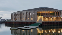
Waterfront Pump Station
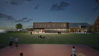
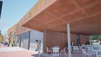
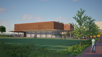
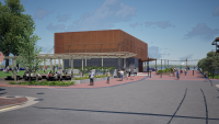
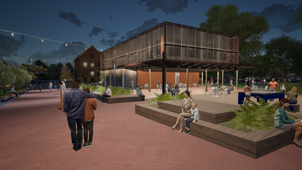
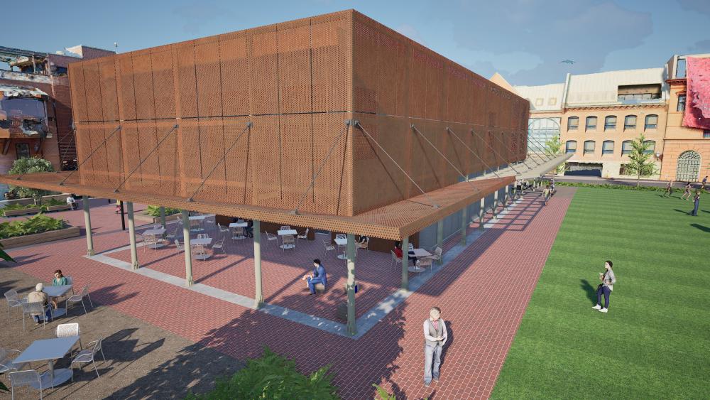
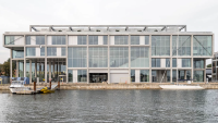
The following images are artist renderings depicting the current Pump Station design as of Spring 2025. The renderings and design concepts presented are currently under development, for conceptual reference only, and subject to change and design progresses. Additional information about current conditions and proposed design elements can be found in the sections below.
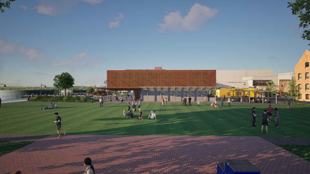


Daytime view of Waterfront Park and the Pump Station from the walkway on the north side of Waterfront Park.
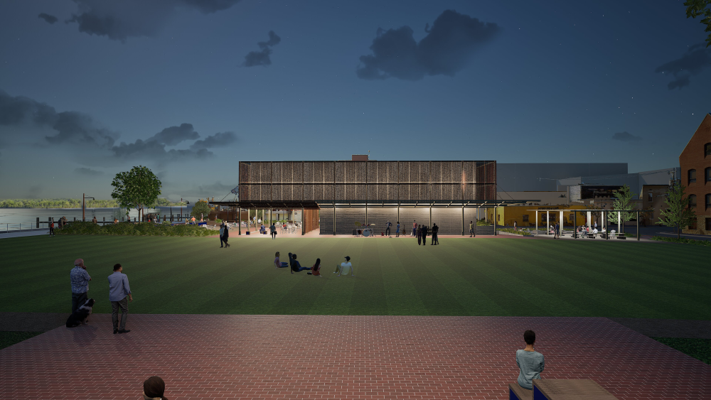
Evening view of Waterfront Park and the Pump Station from the walkway on the north side of Waterfront Park.
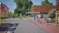
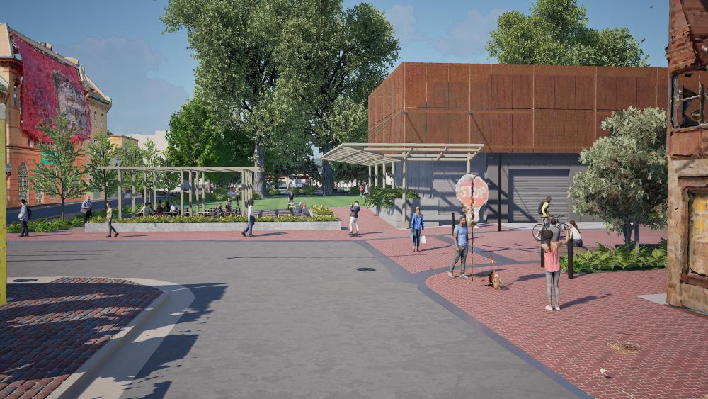
Daytime view of the Prince Street Pedestrian Plaza and Pump Station from the promenade.
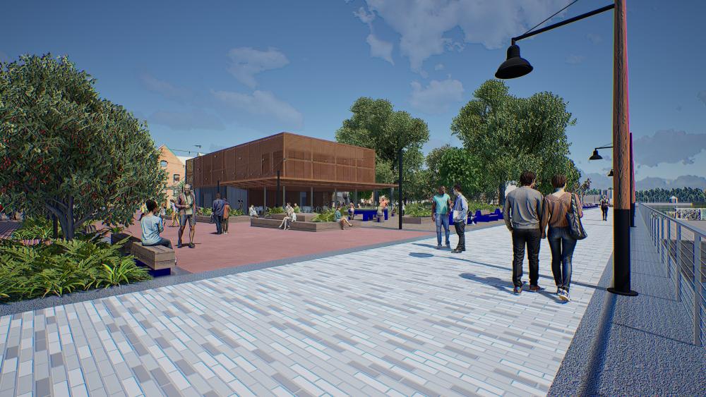
Evening view of the Prince Street Pedestrian Plaza and Pump Station from the promenade.
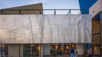
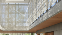
Elevated view of the metal scrim on the Pump Station.
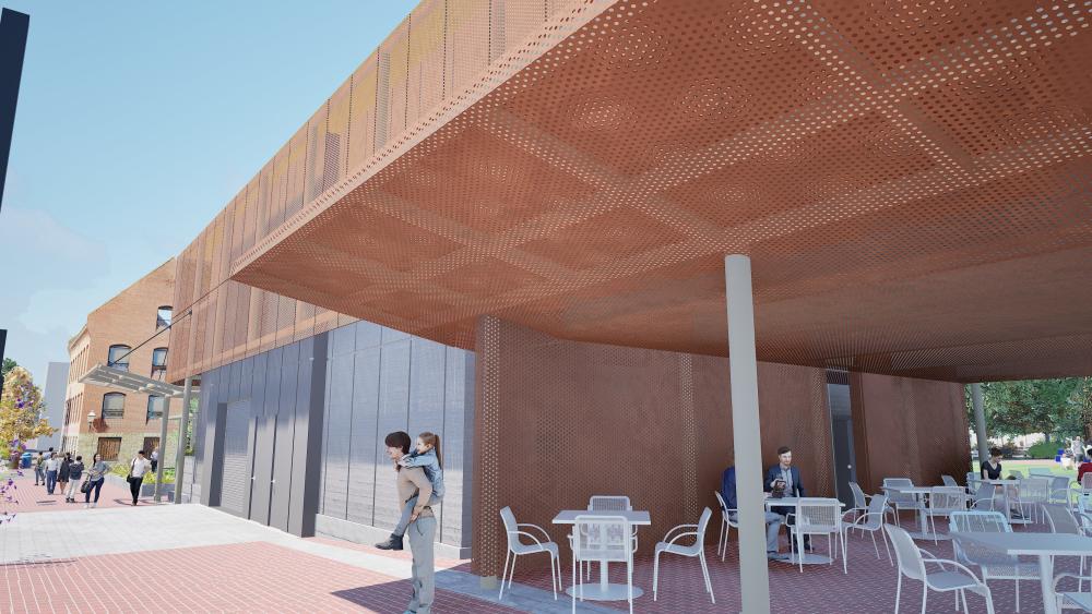
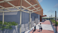
View of the metal scrim canopy on the Pump Station from the Prince Street Pedestrian Plaza.
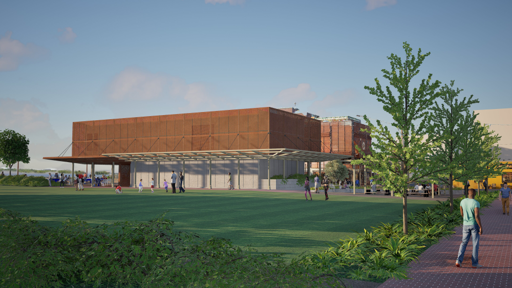
View of the Pump Station and Waterfront Park from the current parking strip on Strand Street.

View of the Pump Station and Prince Street Pedestrian Plaza from the intersection of Prince Street and Strand Street.
View of the Pump Station and western Waterfront Park from Strand Street at the Old Dominion Boat Club.
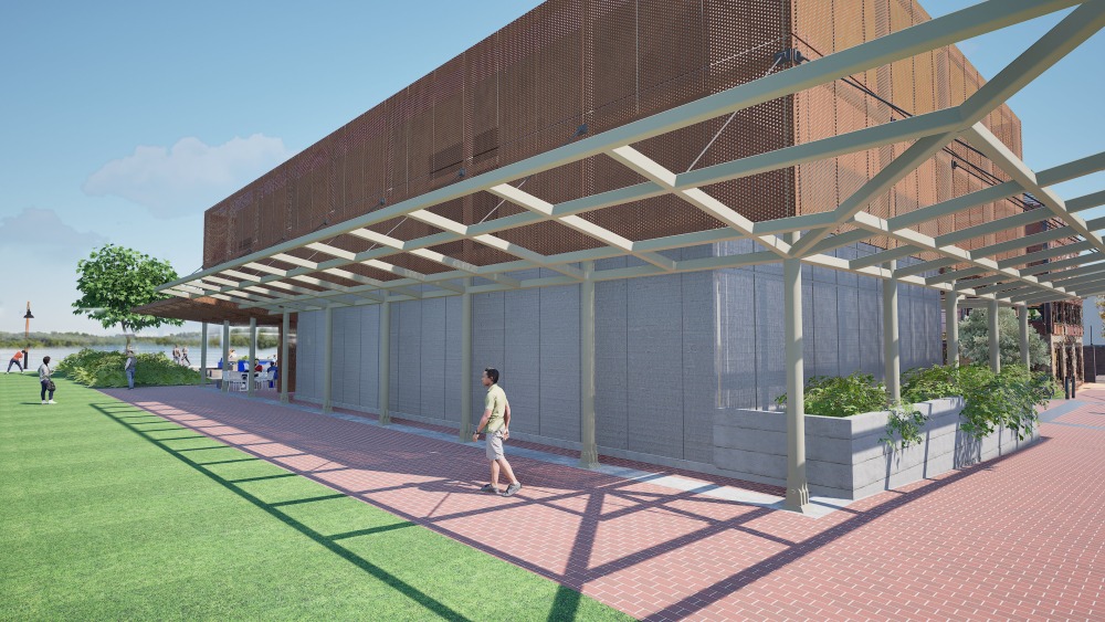
View of the Pump Station northwest corner from Waterfront Park and the West Plaza.
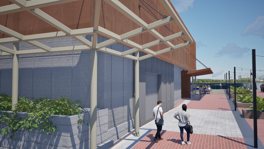
View of the Pump Station southwest corner from Waterfront Park and the Prince Street Pedestrian Plaza.
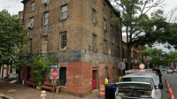
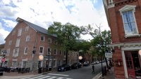
Existing Conditions
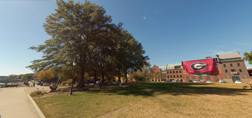
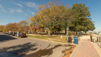


Looking south at Waterfront Park and Prince Street from the Tallship Providence and promenade.
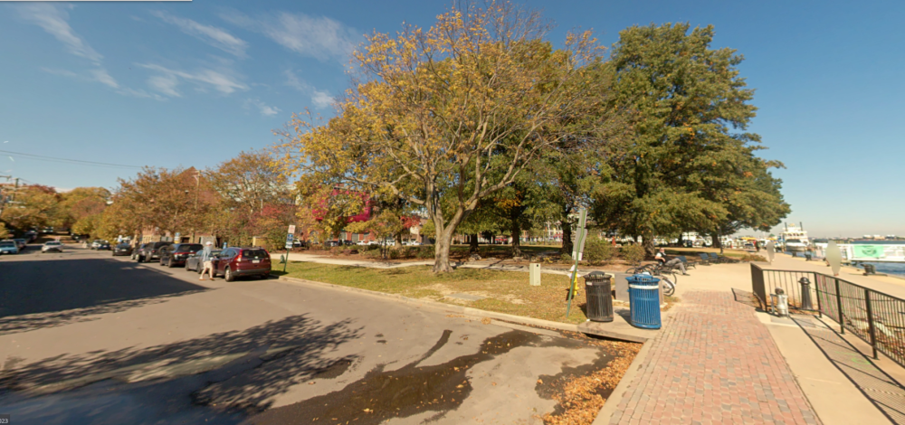
Looking north at Waterfront Park and Prince Street from the promenade at the foot of Prince Street.
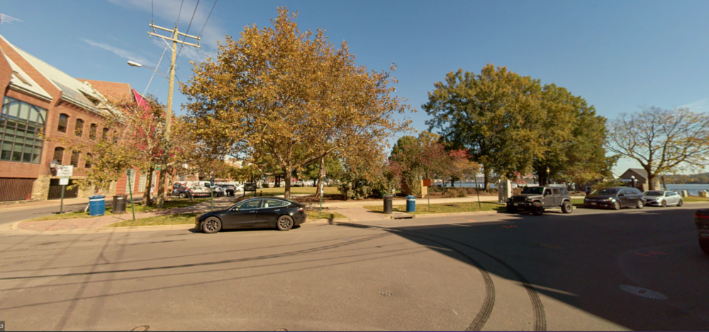
Looking north at Waterfront Park across Prince Street.
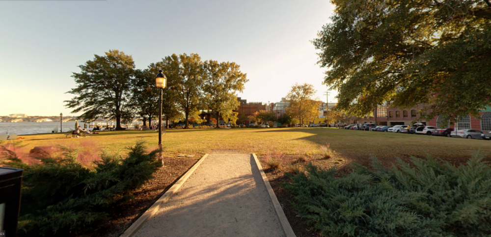
Looking south at Waterfront Park and Prince Street from the mid-park path from King Street Park.
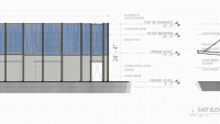
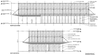
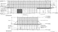
Proposed Building Plans
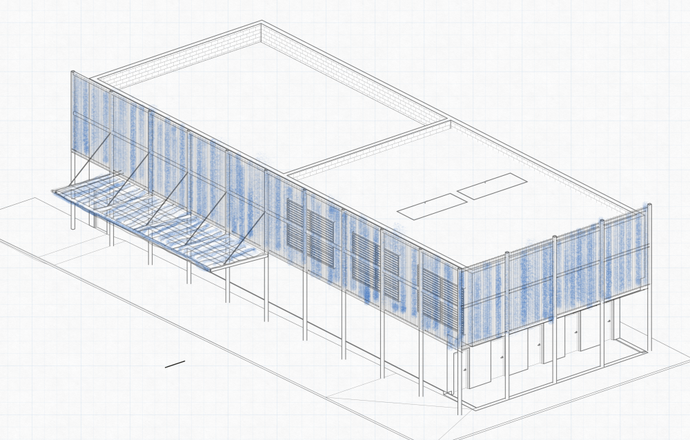
Initial Concept Sketch - 3D view
Initial Concept Sketch - North Elevation

Initial Concept Sketch - East Elevation
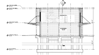
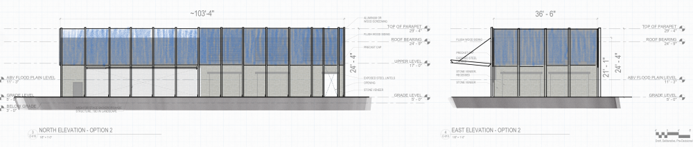
North and East Elevations
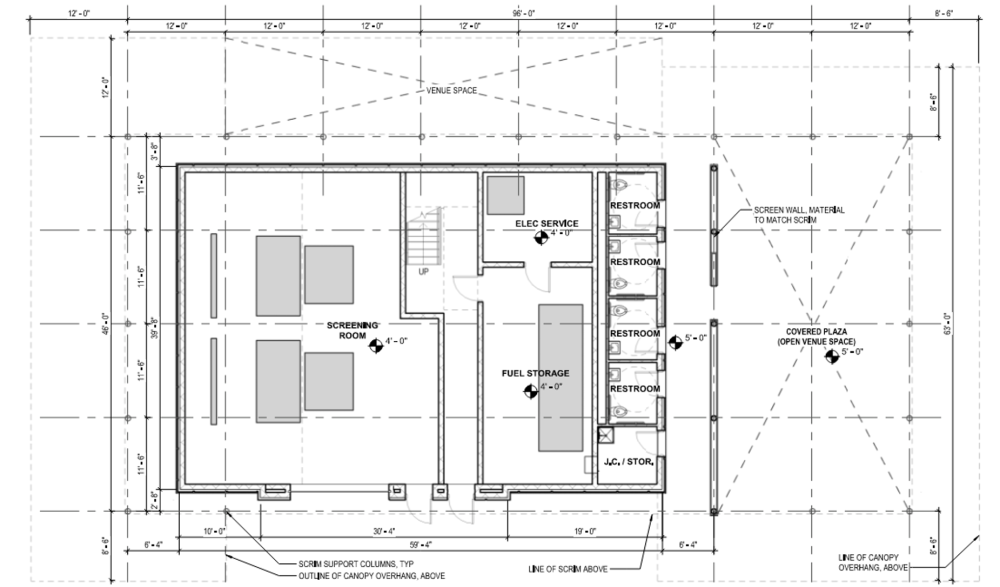
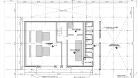
First Floor Plan
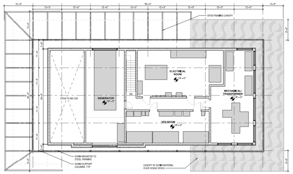
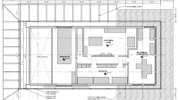
Second Floor Plan
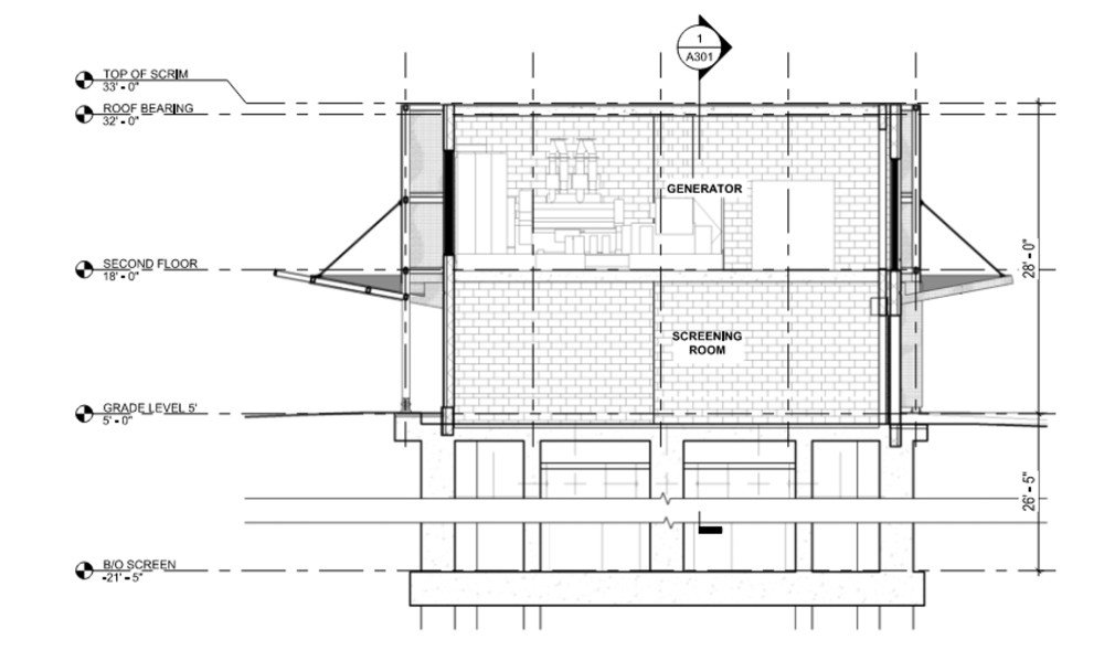
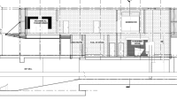
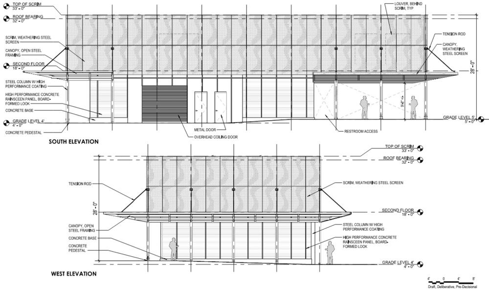
Cross Section
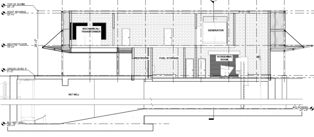
Longitudinal Cross Section
Design Concepts
The following images illustrate key concepts informing the current pump station design.


Emphasis on horizontal grid lines within existing Old Town and the reflection of that image in local art
Emphasis on horizontal grid lines within existing Old Town and the reflection of that image in local art
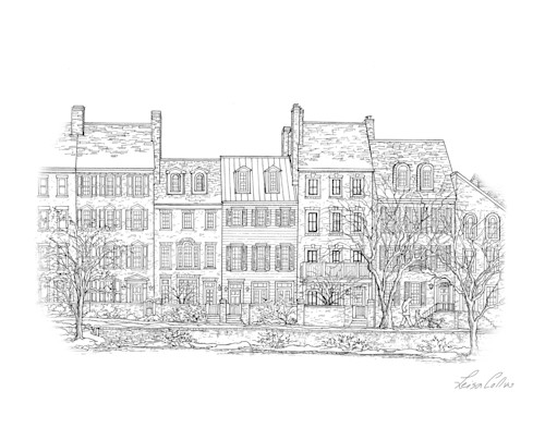
Emphasis on horizontal grid lines within existing Old Town and the reflection of that image in local art
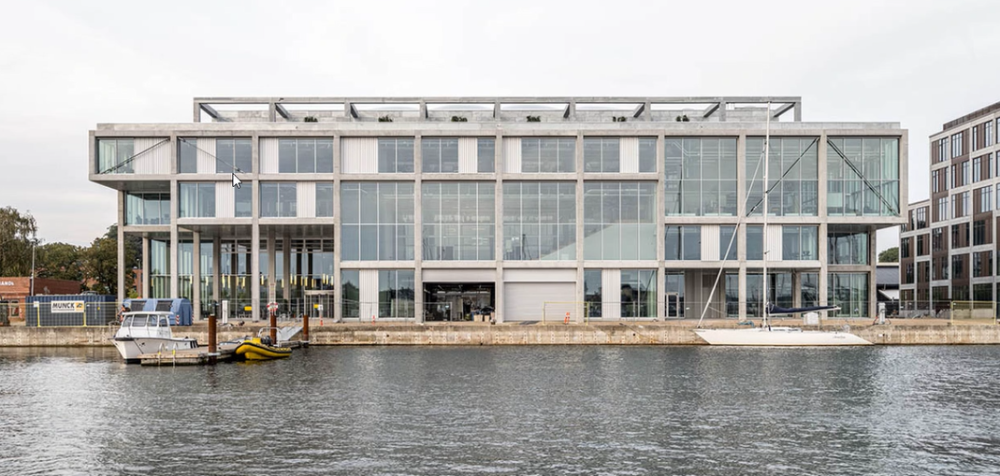
Emphasis on horizontal elements through glazing and structural design
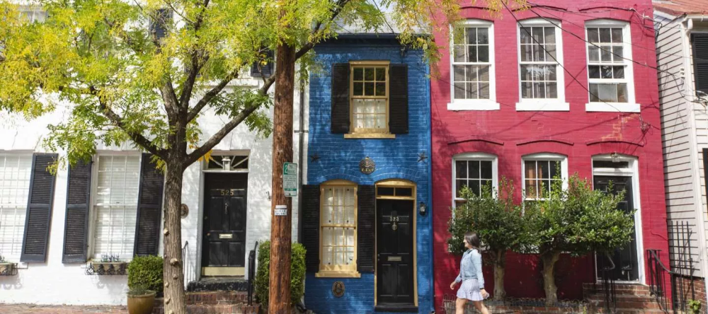
Surrounding buildings with various methods of horizontal lines through material breaks, introduction of color, and patterning
Surrounding buildings with various methods of horizontal lines through material breaks, introduction of color, and patterning
Surrounding buildings with various methods of horizontal lines through material breaks, introduction of color, and patterning
Surrounding buildings with various methods of horizontal lines through materials and massing.
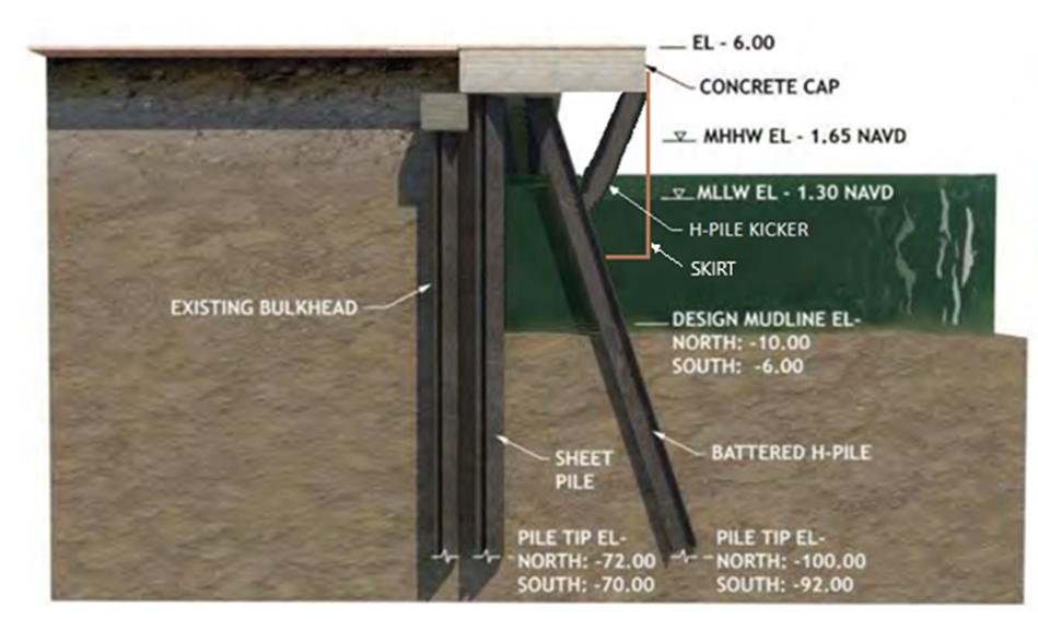
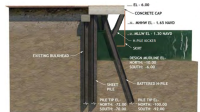
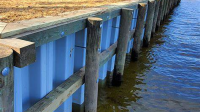
Section of a typical waterfront retaining wall
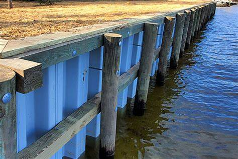
Image of a typical waterfront retaining wall.
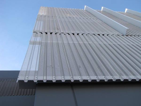
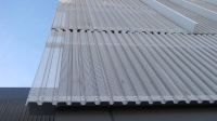
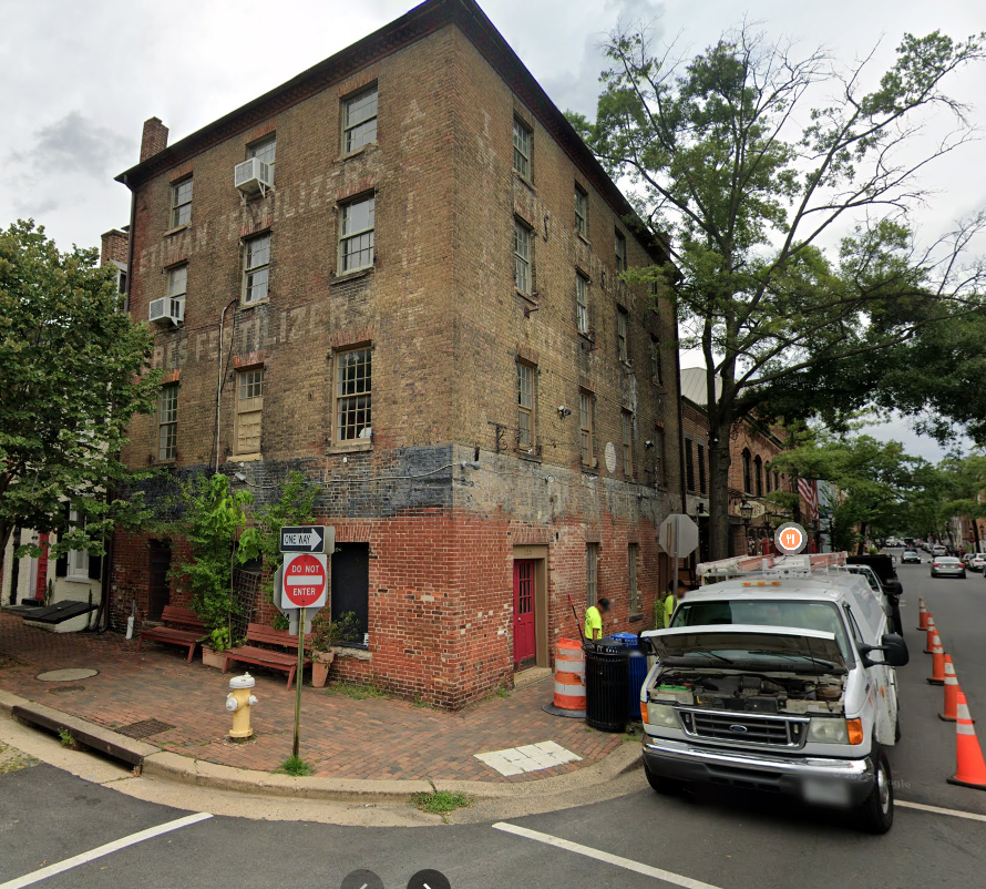
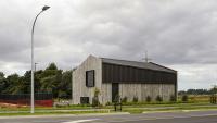
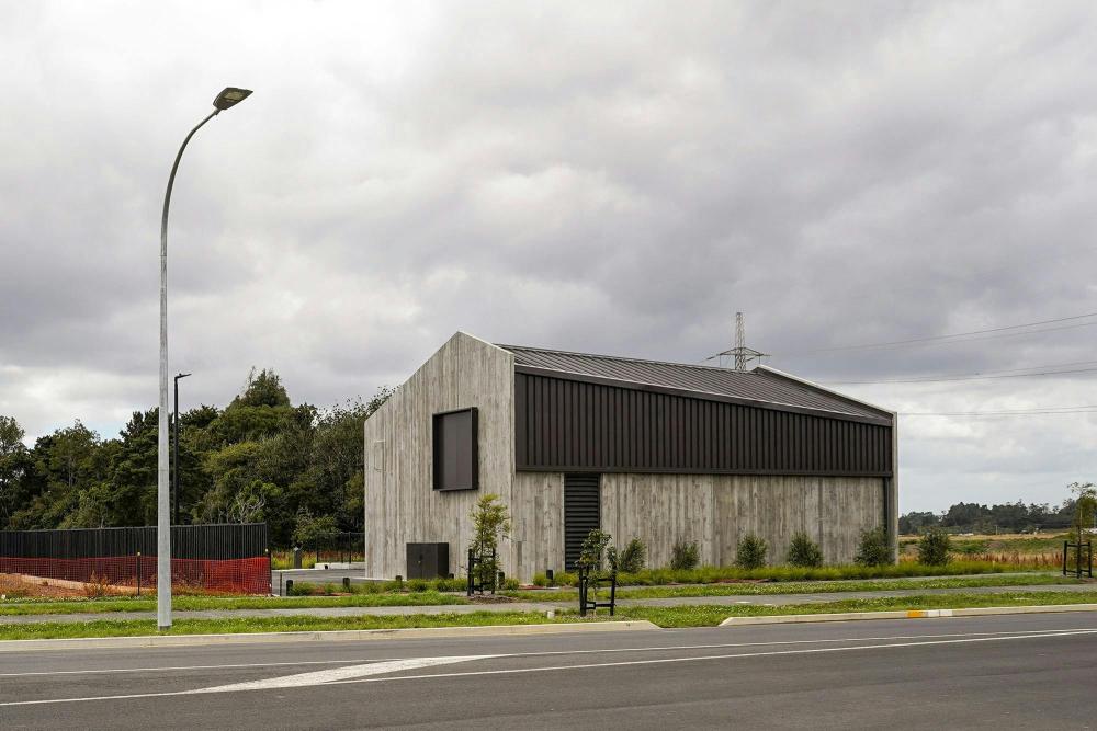
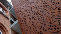
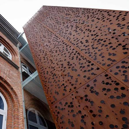
Corrugated metal as architectural element
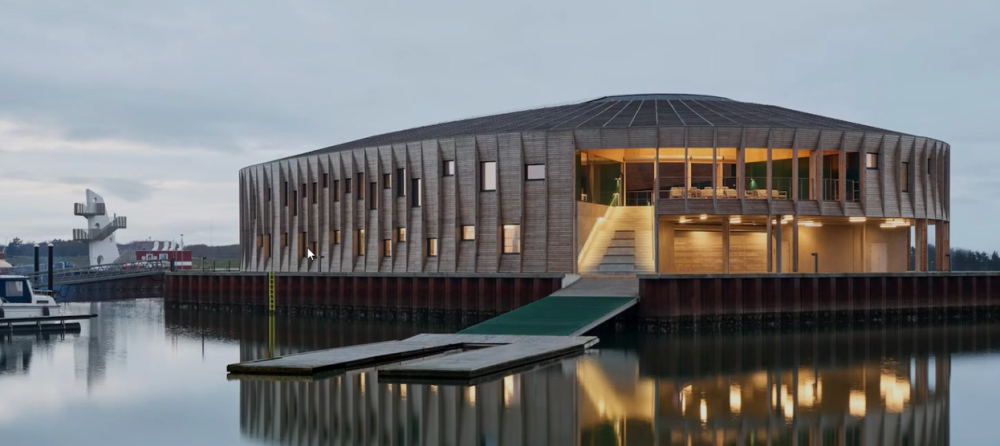
Design Precedents
The following images illustrate how these key design concepts appear when implemented.

Architecture as a backdrop to the park
Low maintenance natural materials
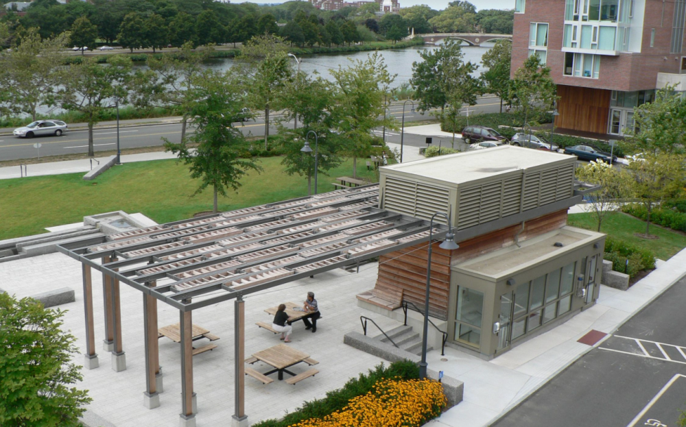
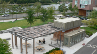
Canopy and plaza
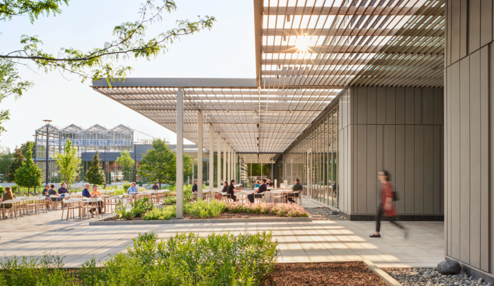
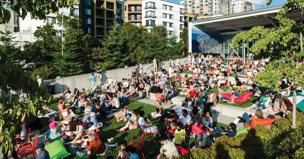
Integration of architecture, landscape, and public space
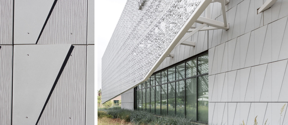
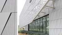
Metal scrim and relationship to architectural facade
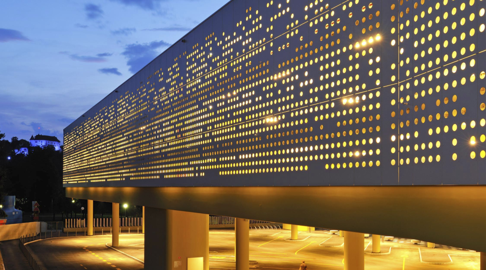
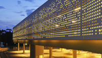
Night-time illumination scrim as visual beacon
Scrim in relationship to streetscape
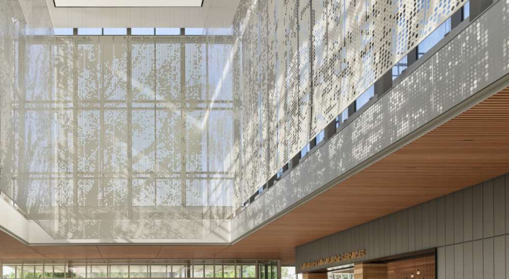
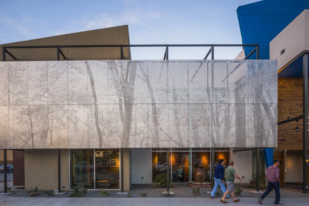
Scrim as visual narrative
Building Materials
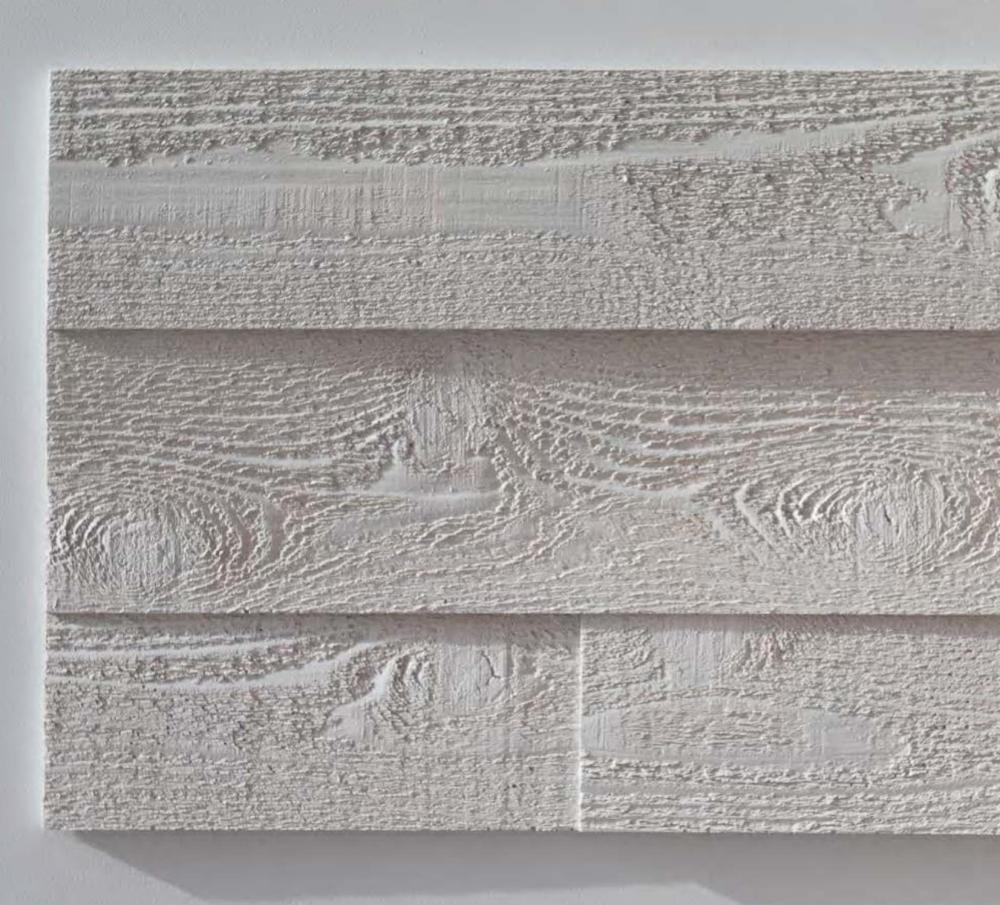

Board-formed concrete panel to reference historic cribbing
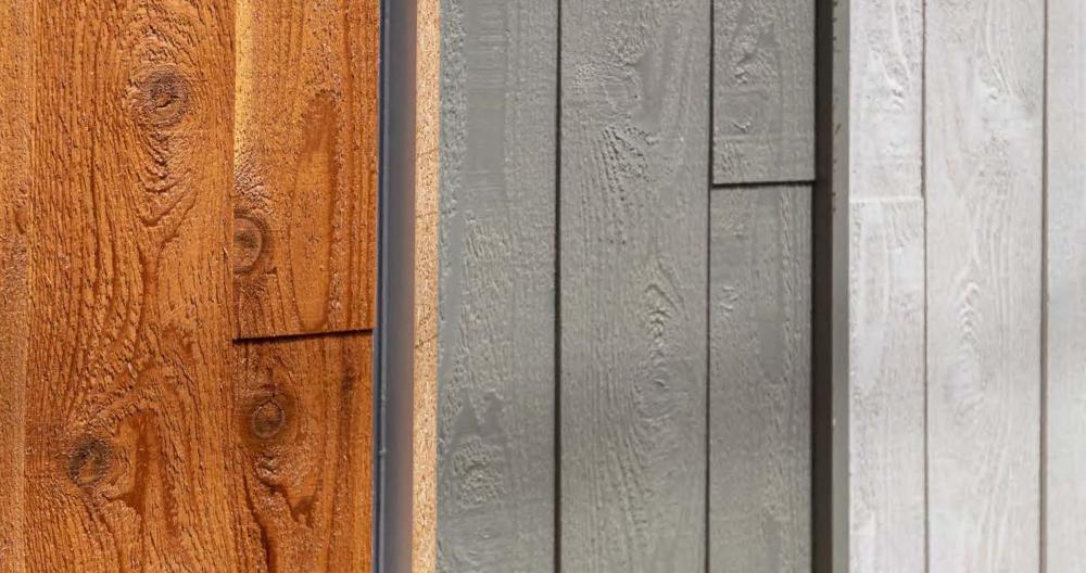
Pre-cast concrete panel mold to product reference
Scrim material inspiration
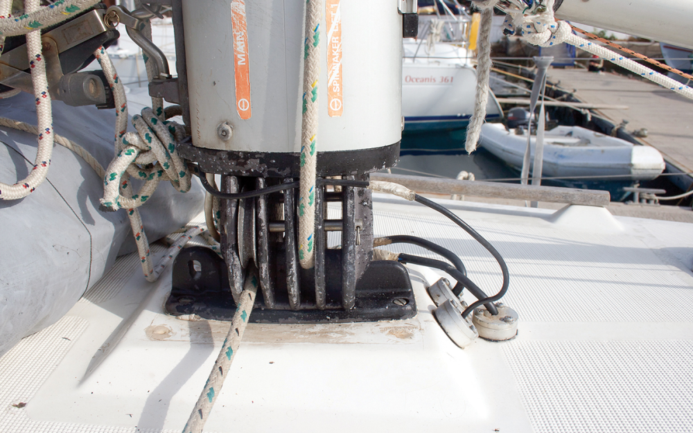
Column as a device to represent nautical surrounds
Structural techtonics and relationship to sail boats
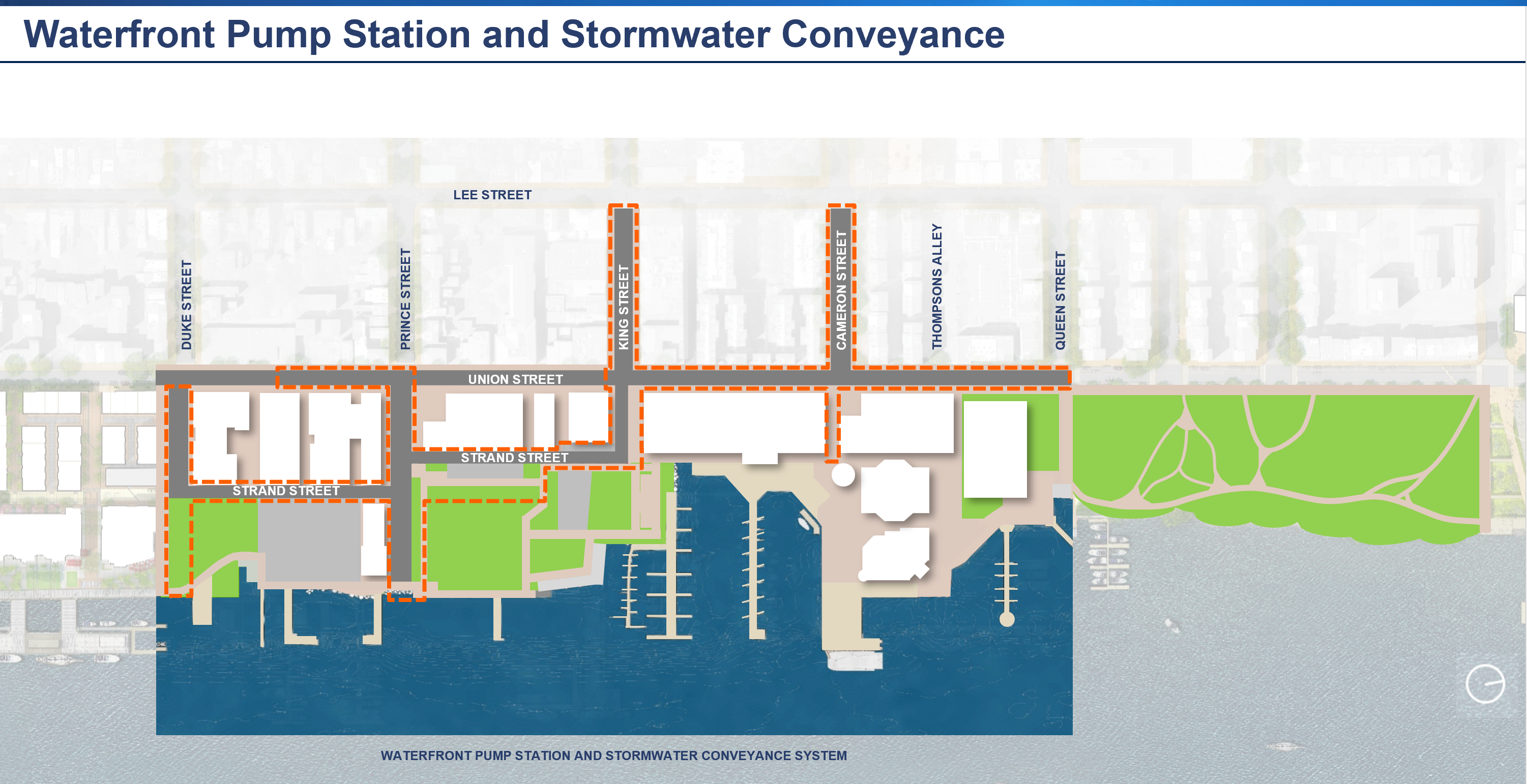
Storm Sewer System Replacement and Improvement
A network of new large stormwater pipes will be installed under portions of Union Street, Strand Street, Duke Street, Prince Street, King Street, Cameron Street, and Thompsons Alley, and will replace the existing undersized and aging sewer pipes. The new system will convey water from flood-prone areas along Alexandria's Waterfront to the new pump station, and then out into the Potomac River.
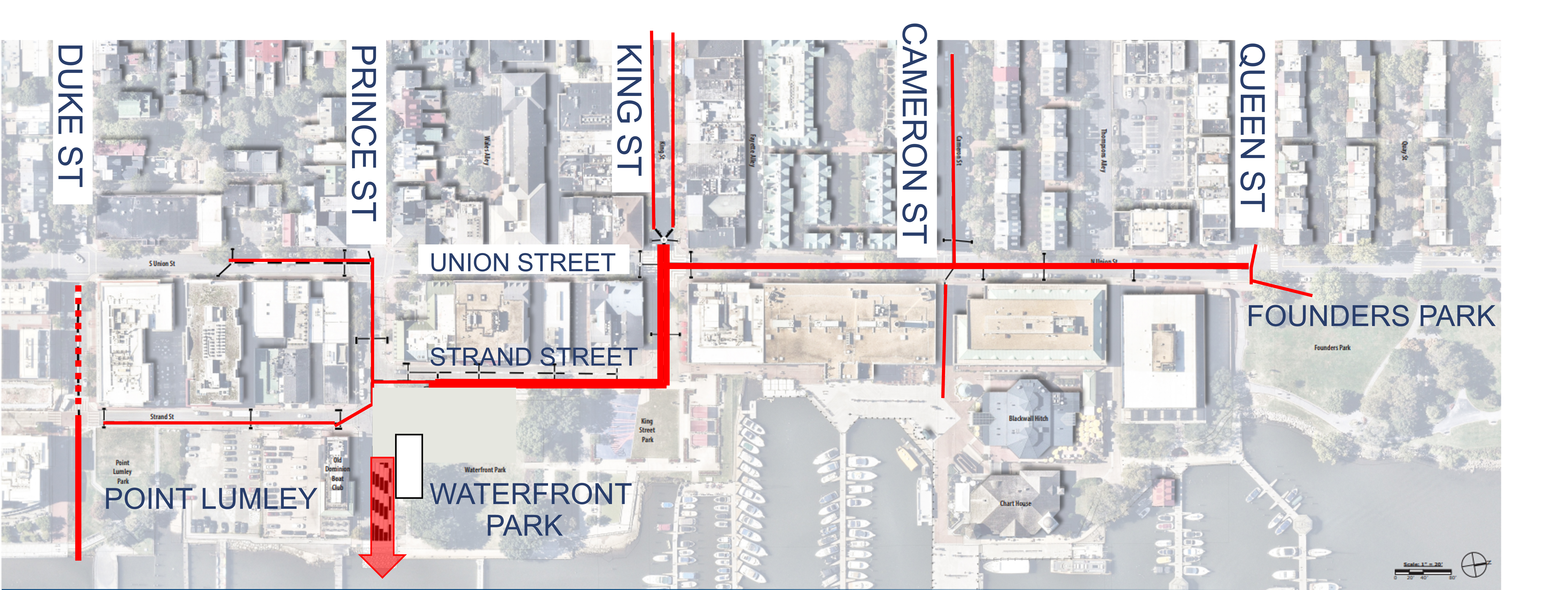
The red lines indicate where existing and new pipes will be placed to facilitate the conveyance of storm water from inland areas to the Potomac River.
Pump Station Design History
The following section documents the web content previously posted about the Pump Station design development.
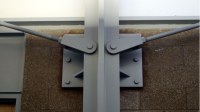
The City determined that a single pump station will perform and provide the level of service necessary to satisfy the project objectives. The structure must comply with building codes, meet certain floodproofing, structural integrity, and maintenance access requirements to operate correctly, as well as reflect industry best practices for resiliency and redundancy for critical infrastructure. The final design will also reflect input from Alexandria Board of Architectural Review.
The project team will continue to evolve the design to minimize park and visual impacts while integrating the facility and important program support services into the public space.
Pump Station Location
Pump Station Features:
- Performance of two pump stations in one location
- Public restrooms
- Electric power for park programs
- Opportunity to provide other City event facilities
The City considered two orientations for the pump station in Waterfront Park: 1) along Strand Street and 2) along Prince Street. The following images illustrate examples of how the pump station could integrate into the landscape of Waterfront Park. Additional information about the Waterfront Park location options can be found in the November 25, 2024, Public Meeting Presentation and display boards available on the Waterfront Flood Mitigation Community Engagement webpage.
Strand Street Orientation
Prince Street Orientation
* All designs are drafts, deliberative, and pre-decisional.
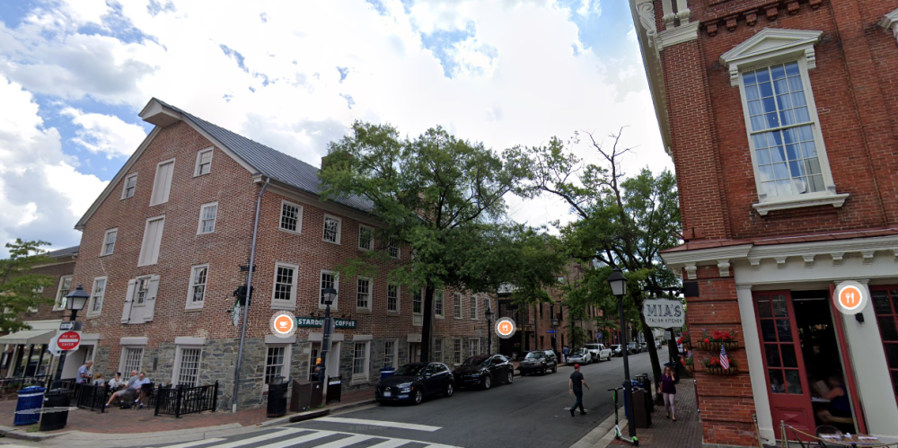
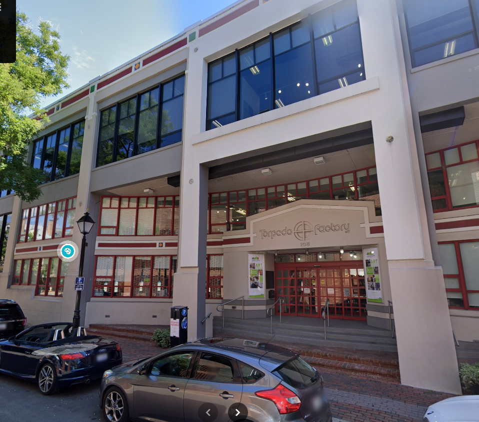
In addition to Waterfront Park, the City analyzed four potential pump station locations: 110 South Union Street, 1 Prince Street, 2 and 6 Prince Street, and Point Lumley Park Parking Lot. Read the September 9, 2024 memorandum to City Council regarding this analysis, watch the January 28, 2025 presentation to City Council on pump station alternatives (presentation starts at 2:56:39), and/or download the City Council presentation.