Sanger Avenue Safety Improvements
Project Description
The purpose of this project is to evaluate improvements to make it easier and safer for people of all ages, abilities, and modes of travel to use Sanger Avenue.
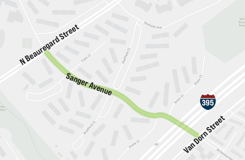
Project Map

Background
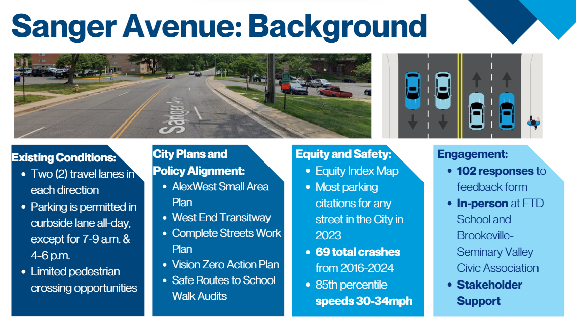
Sanger Avenue, between North Beauregard Street and Van Dorn Street, is a four-lane east-west roadway that provides access to various high-density residential neighborhoods, schools, and bus lines.
There have been over 60 traffic crashes since 2016 on this stretch of Sanger Avenue alone. Of those, over a third resulted in people being injured. Speeding is also common on this corridor, presenting a high risk of injury to people walking, biking, and taking transit.
Safety improvements are being considered for this stretch of Sanger Avenue to improve safety for children and adults walking to the William Ramsay Recreation Center and Ferdinand T. Day Elementary School, protect bus riders boarding/alighting the new West End Transitway, and make it safer for vehicles traveling between North Beauregard Street and Van Dorn Street by decreasing the likelihood of dangerous weaving patterns and angled crashes.
A Safe Routes to School (SRTS) project was recently approved for William Ramsay Elementary, with curb extensions, crossing improvements, and a raised crosswalk coming soon. Multimodal safety improvements to Sanger Avenue are also recommended in the Safe Routes to School Walk Audit for Ferdinand T. Day Elementary.
Sanger Ave will be a key artery of the West End Transitway. Traffic safety improvements are needed to protect riders and bus operators, and also to ensure safe transit operations.
Project Development
Community Engagement
Status: Initiated

Open House - Wednesday, June 11
The City of Alexandria invites community members to an open house featuring design information on four infrastructure projects breaking ground this summer near Sanger Avenue and North Beauregard Street in west Alexandria. The staff and contractors of the Holmes Run Trail - Dora Kelley Fair Weather Crossing Replacement, North Beauregard Street Over Holmes Run Culvert Repairs, Sanger Avenue Safety Improvements, and William Ramsay Safe Routes to Schools will be in attendance and ready to discuss construction plans, work hours, parking restrictions, trail detours, and more.
The Open House will take place on Wednesday, June 11 from 6 to 8 p.m. at William Ramsay Recreation Center, 5650 Sanger Avenue. Stop by at any time to speak with a project team member.
For reasonable disability accommodation, contact Lydia Durand at Lydia.Durand@alexandriava.gov or call 703.746.4622, Virginia Relay 711.
If you prefer communication in another language, free interpretation and translation services are available to you. Please email LanguageAccess@alexandriava.gov or call 703.746.3960.
The project team held in-person engagement opportunities at Ferdinand T. Day Elementary on November 12, 2024 and at Patrick Henry Recreation Center on January 11, 2025 to share project information and consider feedback from the community.
The feedback form to provide comments on the Sanger Avenue Safety Improvements project is now closed.
Thank you for providing feedback!
Planning & Concept Design
Status: Initiated

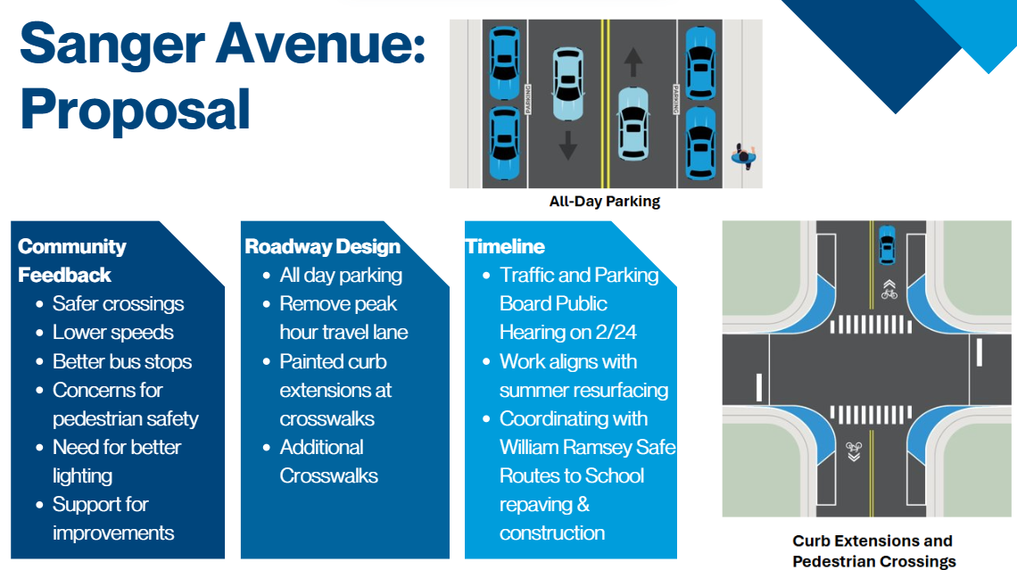
At its February 2025 meeting, the Traffic and Parking Board reviewed the Sanger Avenue Safety Improvements Project. The Board approved three key changes: removal of timed parking restrictions, removal of up to six (6) parking spaces, and removal of one general purpose travel lane in each direction. Presentation and memo are available on the Traffic and Parking Board website.
Construction
Status: Not Started
Construction is anticipated to begin in Summer 2025 in coordination with Sanger Avenue Repaving.
Additional Resources & Related Projects
View the resources below to learn more: