Four Mile Run Dredge Project
Project Overview

The City must perform maintenance on streams and channels — including this federally funded flood-control project — that is consistent with the Operations and Maintenance Manual. Such operations and maintenance that will be completed during the Four Mile Run Dredge Project include:
- Dredging, which will preserve the project’s capacity to carry 100-year floodwaters, as designed by USACE to a width and depth to carry flows during major rain events. Periodic dredging of significant accumulated sediment in the channel is required to maintain conveyance capacity and freeboard for the channel so it can safely carry floodwaters and ensure the protection of homes and properties adjacent to the flood control channel.
- Repairing erosion damage
- Fixing stream corridor degradation
- Clearing debris, vegetation growth, and shoaling
- Maintaining storm sewer infrastructure in the banks of the project
The increasing frequency of intense storm events requires increasing funding for maintenance as climate resiliency and adaption measures consistent with the City’s Climate Emergency Declaration.
Four Mile Run is a nine-mile long stream with a 19.6 square mile highly urbanized watershed covering portions of Arlington and Fairfax Counties and the Cities of Alexandria and Falls Church until it reaches the Potomac River. The lower portion from I-395 downstream to National Airport is within a hardened flood-control channel that marks a shared boundary between Arlington County and the City of Alexandria. This stretch of Four Mile Run has neighborhoods and businesses that were subjected to repeated flooding beginning in the 1940s.
In response to this flooding, Arlington County and the City of Alexandria forged a partnership with the U.S. Army Corps of Engineers (USACE) to design and build the flood-control channel in the lower portion, with construction taking place in the late 1970s and early 1980s. Since its completion over 20 years ago, the channel has safely conveyed the high storm flows through the two jurisdictions and prevented flooding. Shared responsibility for operations and maintenance of the Four Mile Run East and West Levee Systems includes the open channel of Four Mile Run, with the north side being Arlington County’s responsibility and the south side being the City’s responsibility. The shared maintenance of the open channel of Four Mile Run includes clearing of debris, vegetation growth, and shoaling as required by the USACE annual inspection program.
The project is in partnership with Arlington County, Virginia.

Project Updates
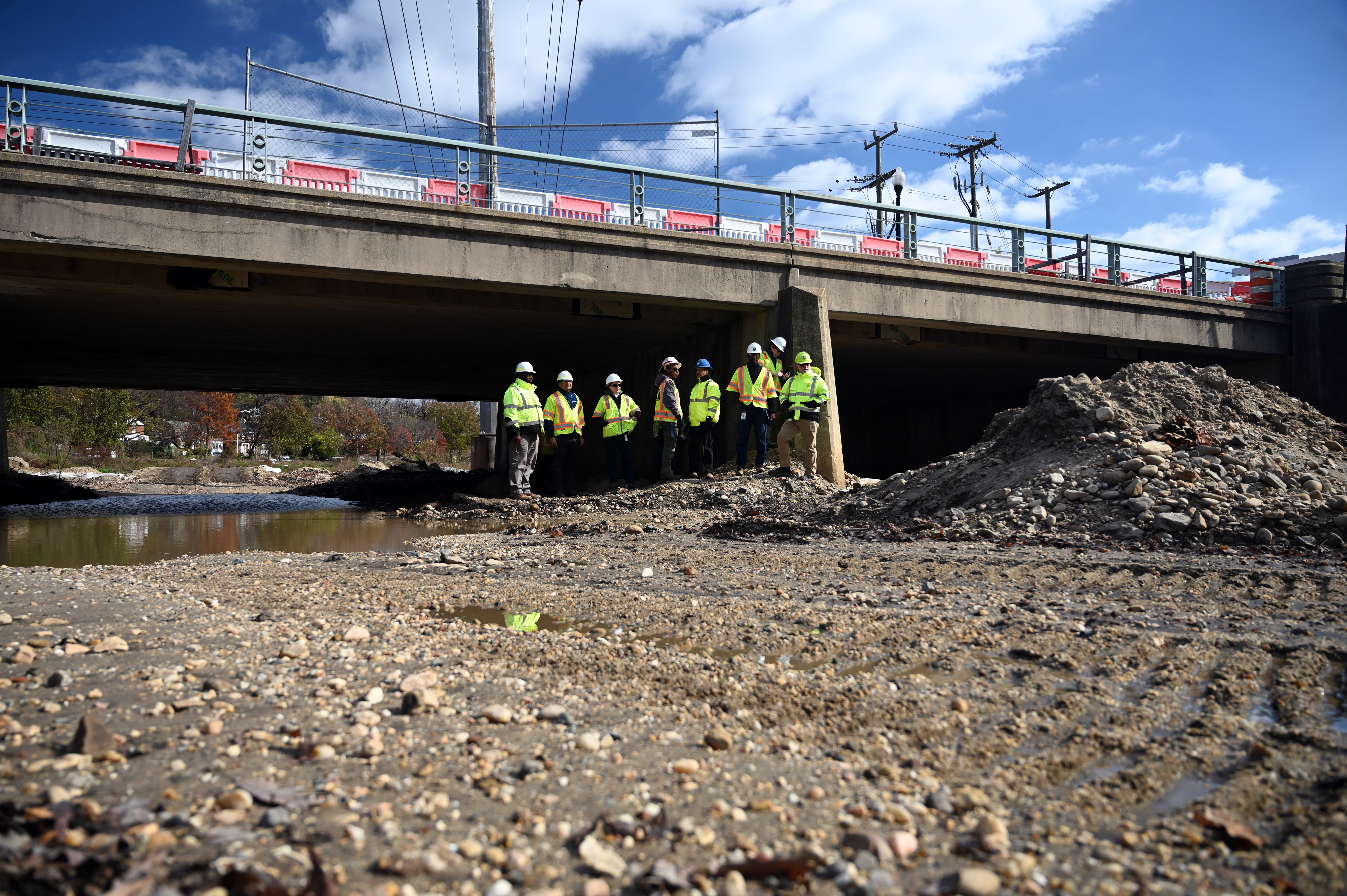
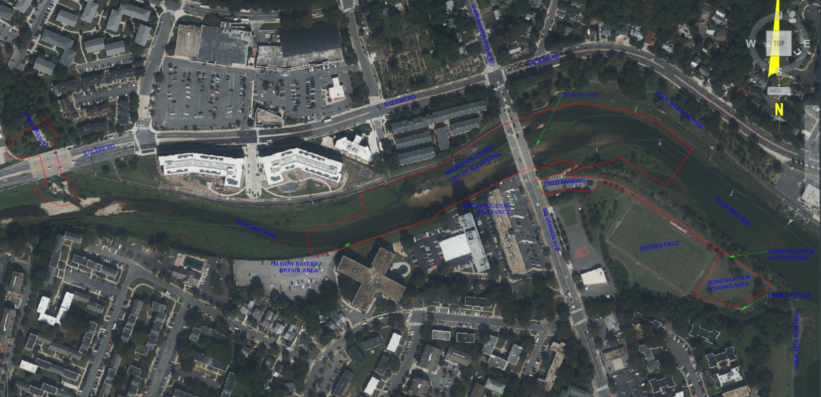
The Four Mile Run Dredge Project will entail the removal of approximately 1,200 linear feet of accumulated sediment (dredge) from the Four Mile Run channel, upstream and downstream of the Mount Vernon bridge. The proposed dredging will restore the available capacity to provide the original design freeboard set by the USACE. Project work will be conducted in environmentally sensitive areas which include the Resource Protection Area (RPA), federally-designated 100-year floodplain, federally-designated “waters of the United States”, and U.S. Army Corps of Engineers Flood Control Levee and Channel.

Project Timeline
- Project Design: 2020-2021
- Construction Procurement: Winter, 2022
- Outreach: April-August 2022
- Construction: September 2022 - February 2023
Project Resources
- Four Mile Run Master Plan
- MOU with Arlington
- Four Mile Run Restoration Project
- Four Mile Run Conservancy
- Public Notice Letter, May 10, 2022
- VMRC #16-1420 Final Permit Extension, December 13, 2021
- Permit #16-1420 Commonwealth of VA Marine Resources Commission Authorization (February 21, 2017 - January 24, 2027)
- US Army Corps of Engineers Nationwide Permit 31 Authorization, October 23, 2020
- Nationwide Permit (31) Maintenance of Existing Flood Control Facilities
Community Outreach
May 17, 2022, 7:00 p.m.
Virtual public meeting will be held in partnership with Arlington County; the recording is in both English and Spanish.