Transit Planning Program
Transit Planning Program FY26 Work Plan & Annual Report
The City develops an annual Transit Program Work Plan that provides a look ahead to key objectives for the fiscal year as well as accomplishments from the previous year.
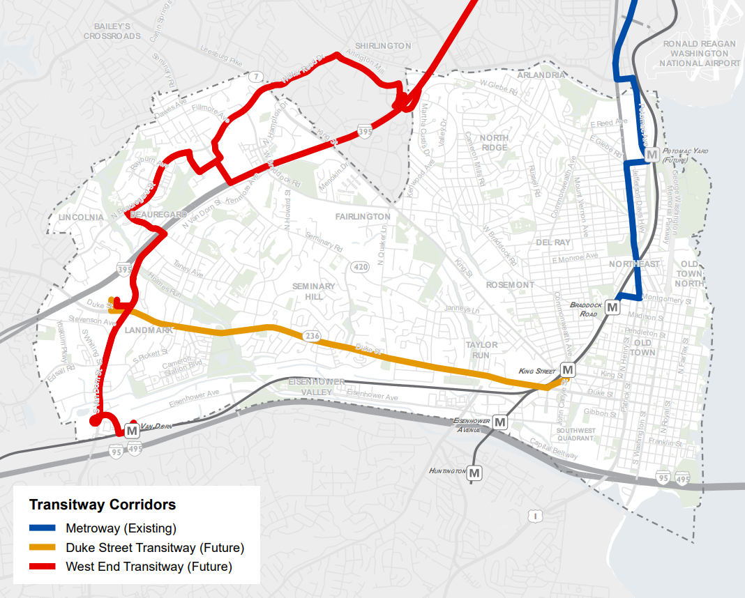
Transitway Corridors
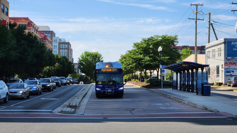
The City has three Transitway Corridors that were originally identified in the 2008 Transportation Master Plan and were reaffirmed in the 2012 Transit Corridors Feasibility Study. Transitways are corridors that include dedicated space for the exclusive use of transit vehicles and provide the greatest level of transit reliability, speed, and comfort available on public streets. Because these are large capital projects, they all include phased implementation that is also tied to development along these corridors.

Transit Centers
A transit center is a transportation hub that acts as a regional node connecting various modes of transportation. Typically, these locations provide amenities for riders to make transit more accessible. Currently, the City has three transit centers in operation at Mark Center, King Street Metro, and Braddock Road Metro, and two transit centers in the pipeline.

Mark Center Station
The Mark Center Transit Center, created in 2011 to serve new federal employees from the BRAC realignment, features 6 bus stops serving 19 different bus routes, including local DASH to WMATA to commuter buses and private shuttles. More than 1,100 passengers use this facility on a normal (pre-COVID) weekday. Currently, City & DASH staff are working with property owners to expand the existing transit center as part of the redevelopment of an adjacent parcel.
West Alexandria Transit Center (Future)
This project will design and construct a new transit center at the redeveloped Landmark Mall site. The transit center will include six new bus bays, additional transit amenities, and create a multimodal hub for people using the site. The project was included in the West End development plan, and both the West End and Duke Street transitways, along with other DASH and WMATA routes would utilize this transit center.
Visit project site for more information.
Southern Towers (Future)
During the Alexandria West Planning Process, a concept for a new transit center at Southern Towers was developed with the community and key stakeholder. Currently, the City & DASH staff are working with property owners to evaluate project feasibility.
King Street Metrorail Station/Union Station
Provides access to DASH bus, King Street Trolley, Metrobus, WMATA Metrorail, Amtrak and VRE commuter rail, and car-sharing services.
Braddock Road Metrorail Station
Provides access to DASH bus, Metrobus, WMATA Metrorail, Metroway Bus Rapid Transit system, and car-sharing services.
Transit Stop Improvement Program
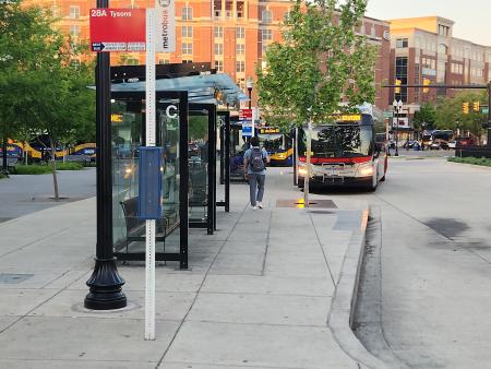
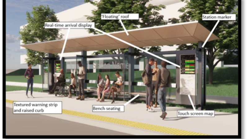
The Transit team is working to ensure Americans with Disabilities Act (ADA) accessibility, improve the bus rider experience, and expand amenities at bus stops across the City of Alexandria.
- Short term ADA Upgrades - Staff identified approximately 24 bus stops that require little work to bring them up to ADA requirements. This work will take place in Fall 2024 and will primarily consist of concrete pads and changing parking requirements.
- Bus Shelters II - Staff has completed reviews of the 60% plans for the installation of 20 bus shelters as part of Phase II of the Bus Shelters project. Full design is expected to be completed in Spring 2025. Installation of the shelters will in occur in 2027.
Regional Transit Coordination
Coordination efforts with regional jurisdictions on transit related themes include team members serving on staff-level working groups and committees that provide support to City officials representing Alexandria on the Northern Virginia Transportation Commission (NVTC), the VRE Operations Board, the WMATA Board and Jurisdictional Coordinating Committee. Through these efforts, City elected officials and staff seek to ensure that Alexandria interests are represented in regional transit funding and policy discussions.
DMV Moves is a joint initiative by the Metropolitan Washington Council of Governments (COG) and the Washington Metropolitan Area Transit Authority (WMATA) to develop a unified vision and sustainable funding model for public transit in our region. City staff is working on this important effort to help decide what our region wants and needs, how much it will cost, how we’ll pay for it, and how to best manage and govern it.
The City of Alexandria is served by three major transit providers:
Plans, Studies, and Initiatives
Transit Vision Plan
The Alexandria Transit Vision Plan outlines a new network of routes within the City of Alexandria that will provide more frequent, all-day bus service and will significantly increase access to frequent transit for low-income, minority and senior residents by 2030.
Alexandria Mobility Plan (AMP)
The Alexandria Mobility Plan (AMP), a strategic update to the 2008 Transportation Master Plan, focuses on expanding high-quality transportation choices so transportation in the city continues to serve the needs of residents, businesses, and visitors as the region grows and new technology impacts the ways we get around.
Alexandria Transit Strategic Plan (ATSP)
The Alexandria Transit Strategic Plan (ATSP) addresses a new requirement from the Virginia Department of Rail and Public Transportation (DRPT) for large and mid-size transit agencies like DASH to receive state funding and outlines service, capital and finance plans on a short and long-term horizon.
Fare Reduction Programs
The City of Alexandria is working with our partners at Metro to enroll residents in the City of Alexandria in available fare reduction programs:
Low-Income Fare Pass Assessment
In 2020, the Metropolitan Washington Regional Council of Governments (MWCOG) awarded the City of Alexandria a Transportation-Land Use Connections grant to study different transit fare pass options that would benefit low-income individuals in the city. This study helped to inform Council's decision for DASH to go fare free when the DASH New Network was introduced in September 2021.
Transit Capital Projects
The Transportation Planning Division manages and supports a number of important capital transit projects that will improve transit facilities and service to Alexandria residents, visitors and workers. For specific project information, please visit the Transit Capital Projects webpage.
Existing Efforts
Getting Around
Learn more on how to get to and through the City of Alexandria, including walking, biking, bus, rail, air, ridesharing, and other modes.


